
timcase@mac.com
Buck Mountain
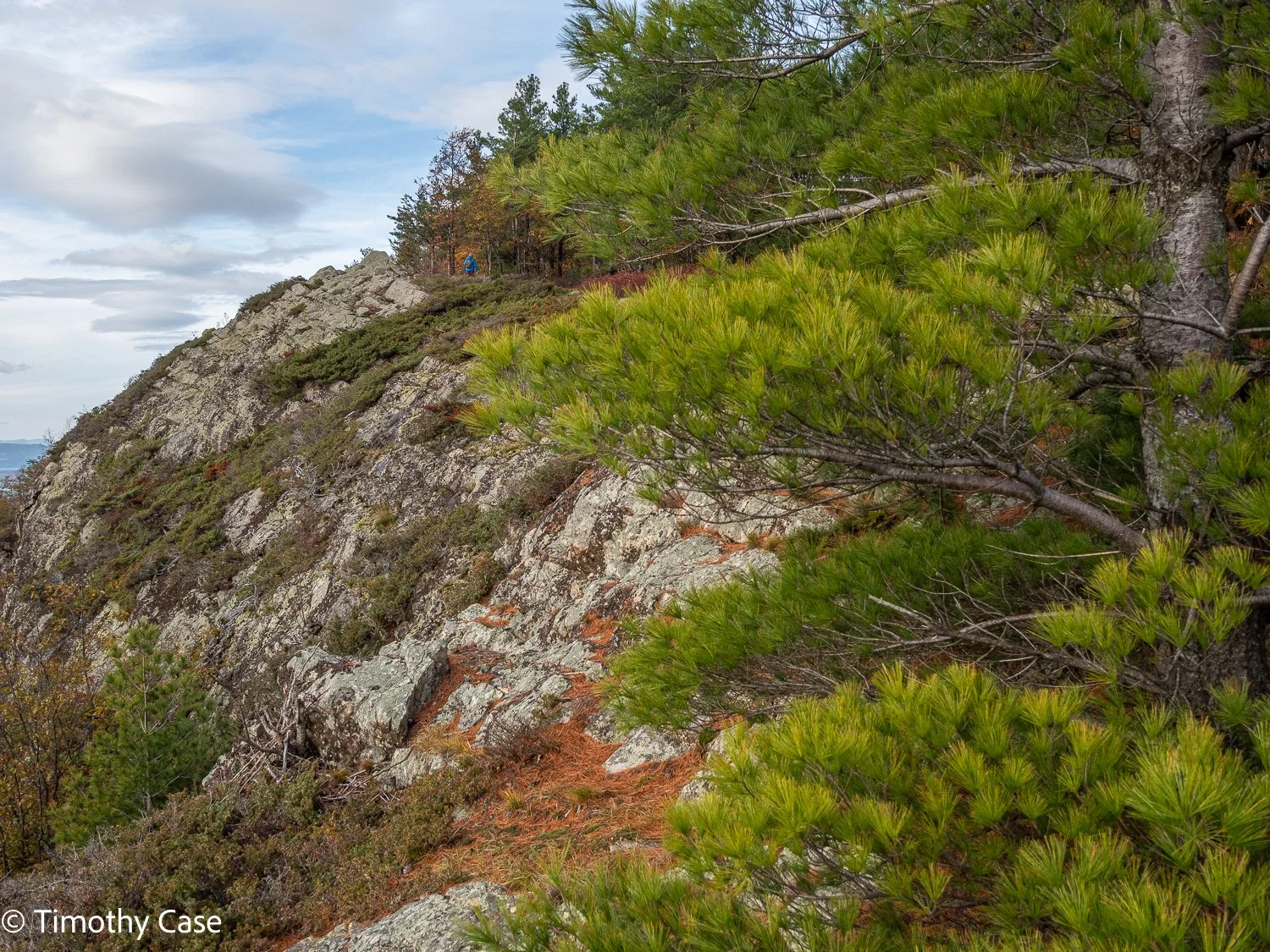
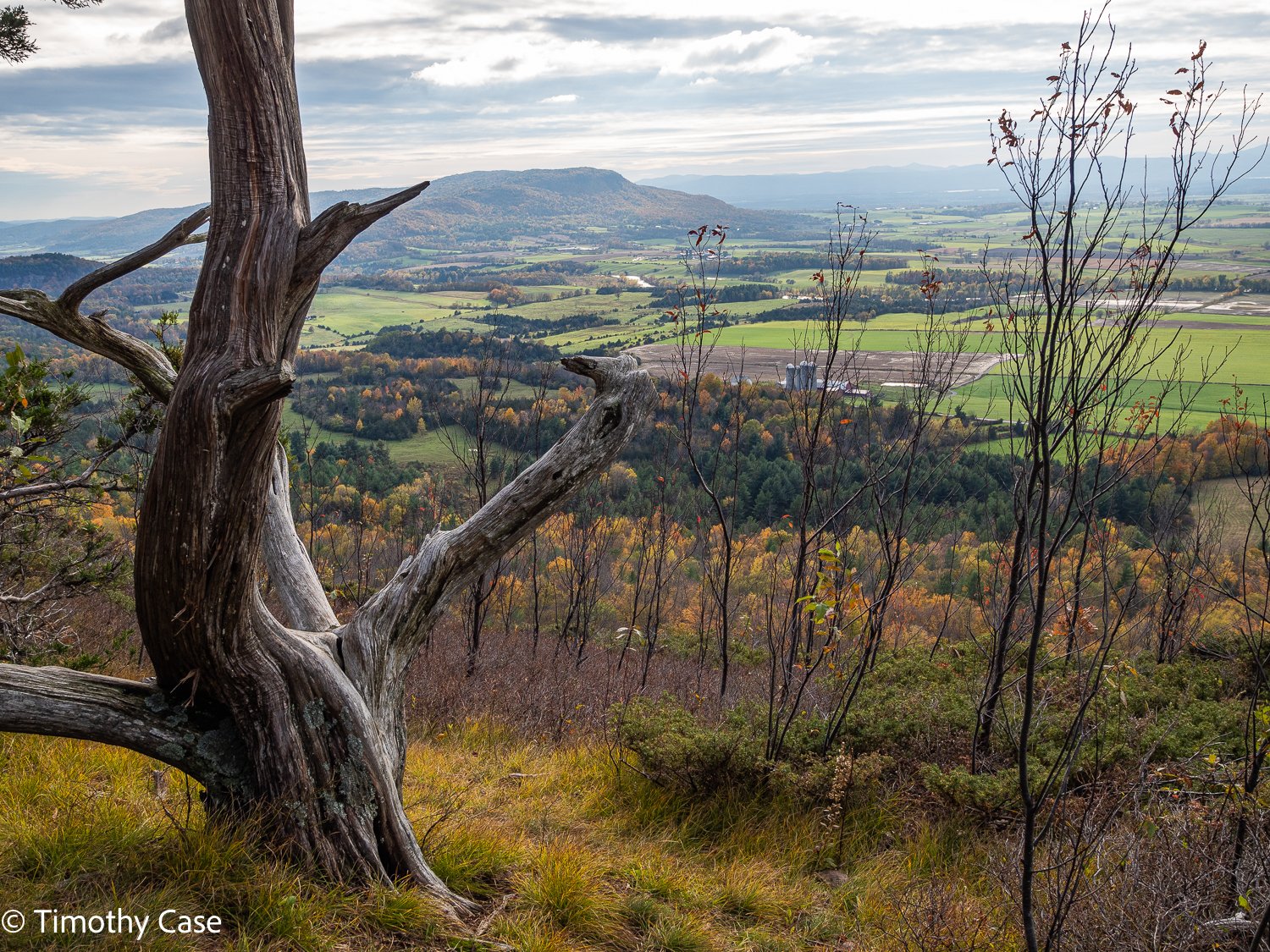
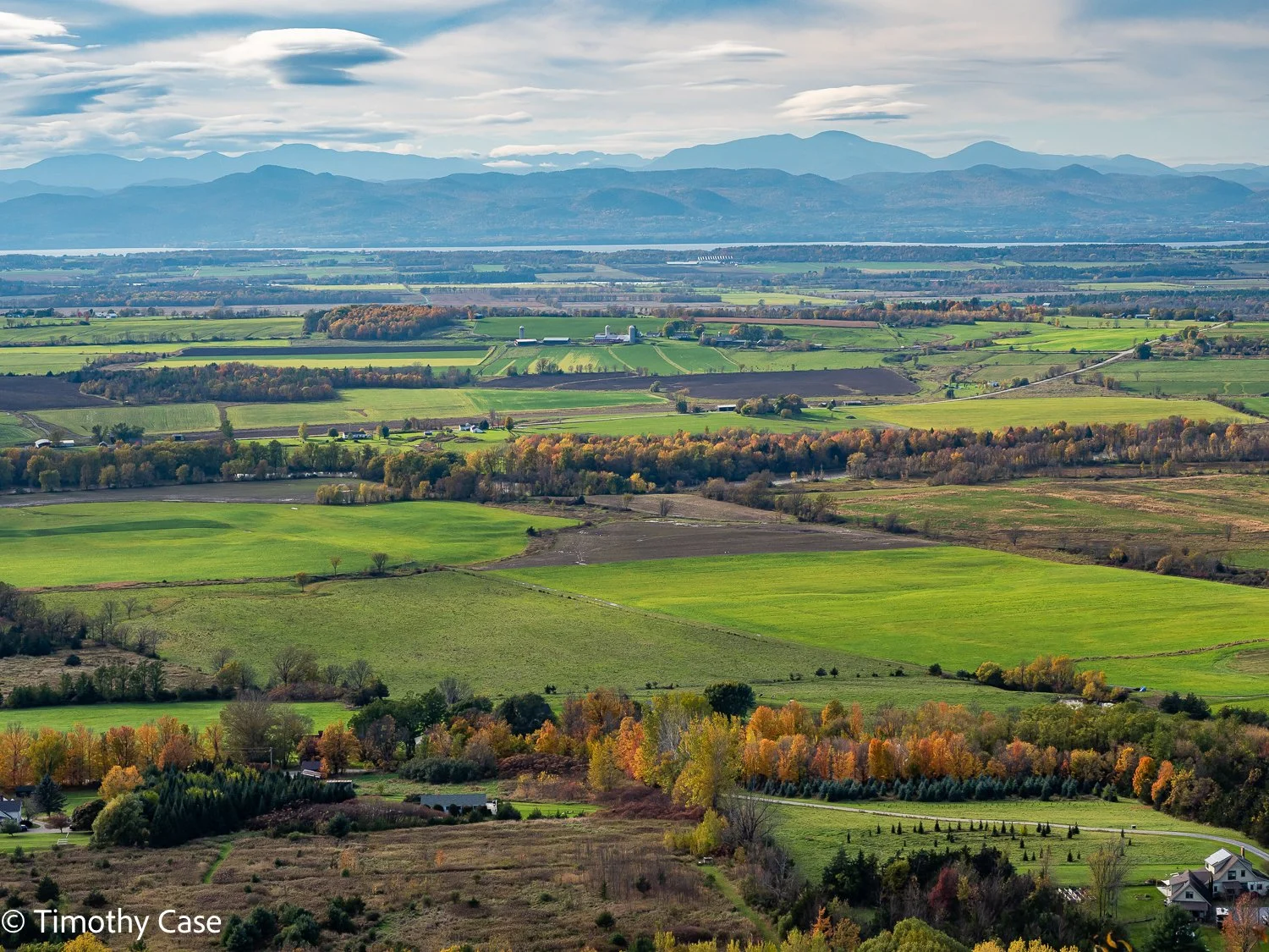
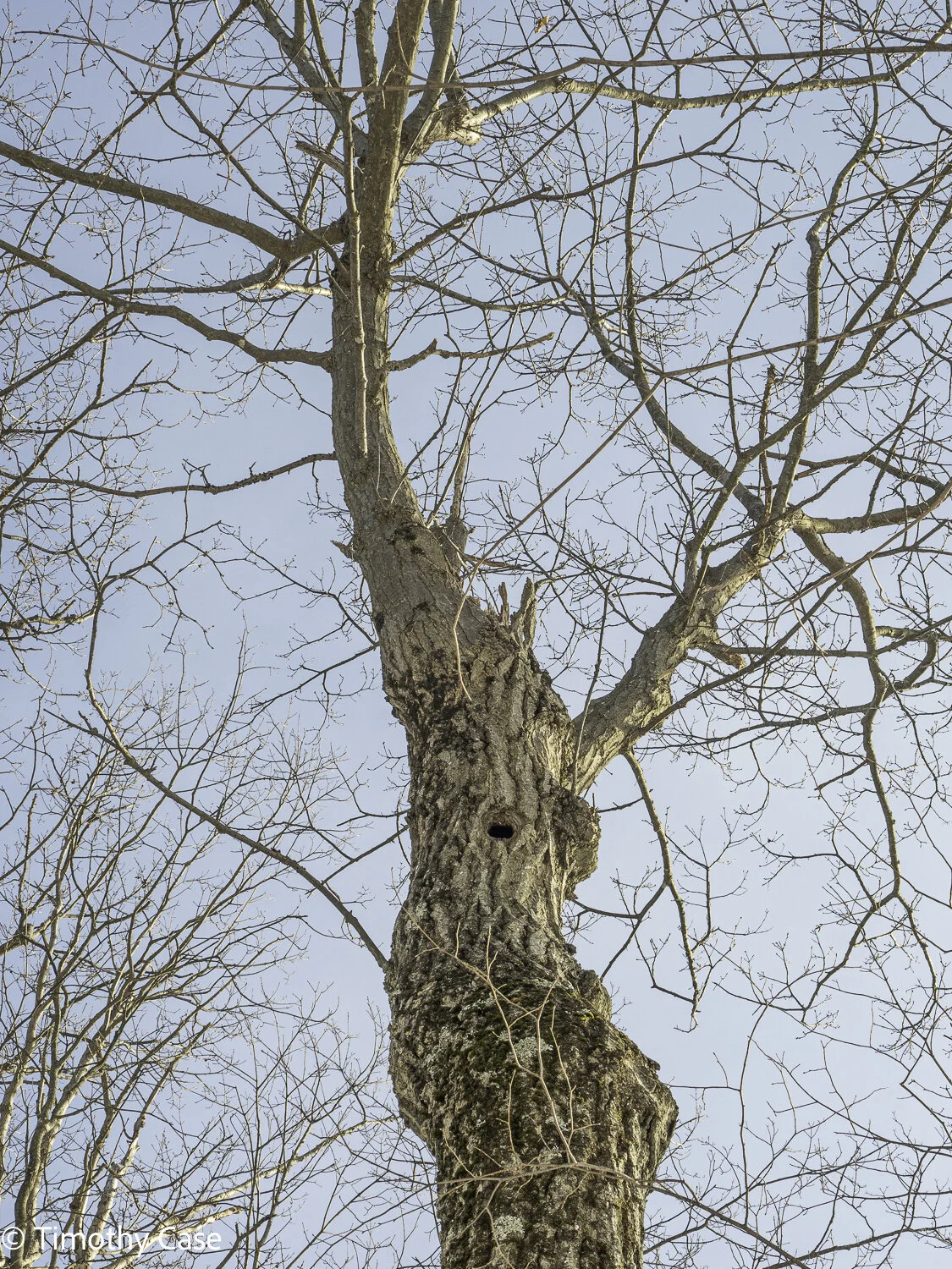
October 27, 2021. It’s beginning to get too cold to cycle, so we’re starting to hike again. Buck Mountain is about 15 minutes from our home and while it’s one of the shorter hikes in our area, its also offers one of the area’s most rewarding vistas with views across Champlain Valley, Lake Champlain and the Adirondack, Green Mountain and Taconic Mountain ranges.
Helen W. Buckner Memorial Natural Area (Bald Mountain)
Our first visit to this Nature Conservancy property, its largest and most ecologically diverse property in Vermont, certainly ‘wowed’ us right from the 2-car parking space at Tim’s Trail with it’s high, sheer ridgeline. The property is almost 4,000 acres, most of it trail-less but the 5 miles of trails (plus another mile of connector trail on private property) provides a wonderful hiking experience. We will return to hike the second trail, the Helen Bruckner Trail, another time.
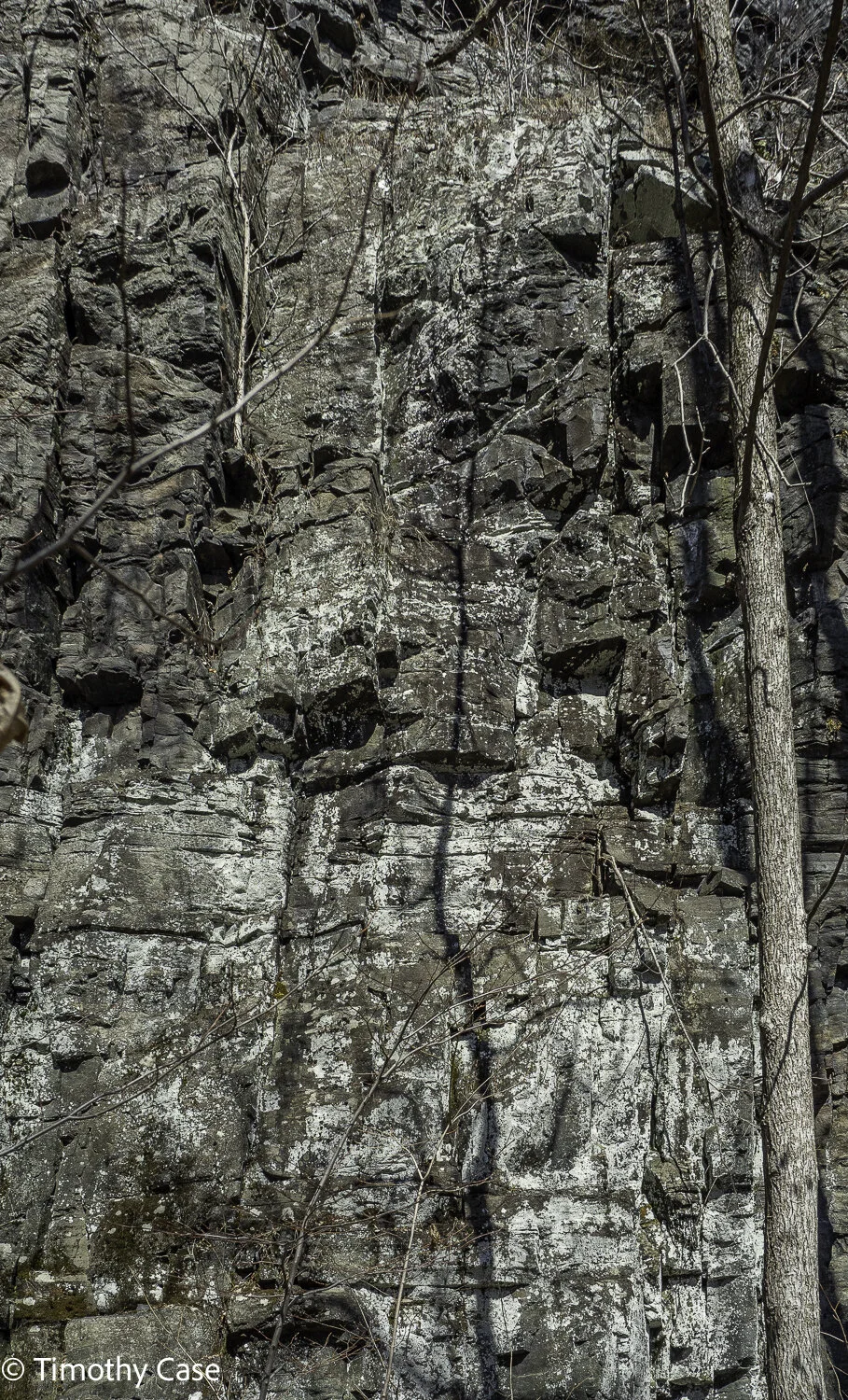
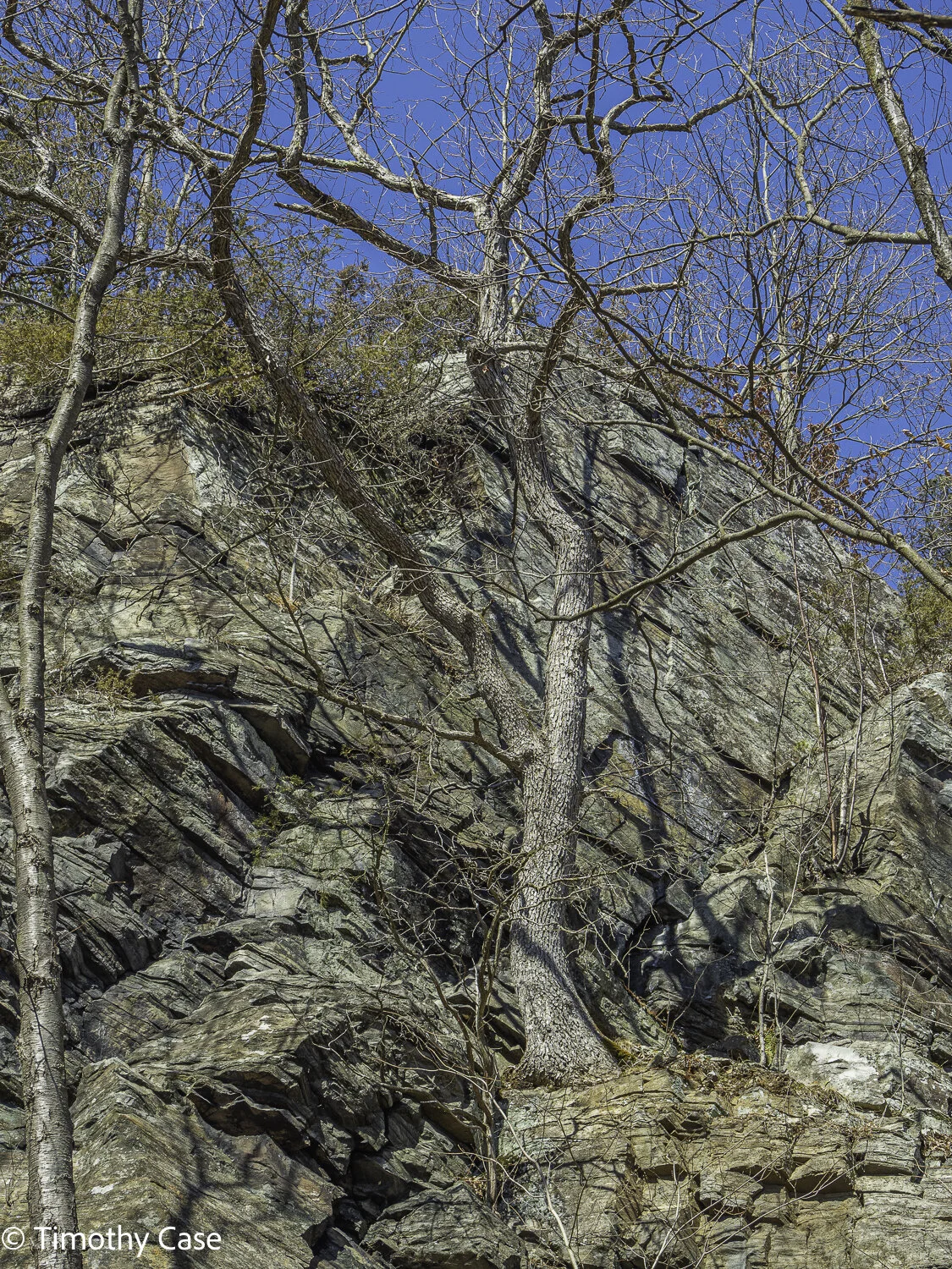
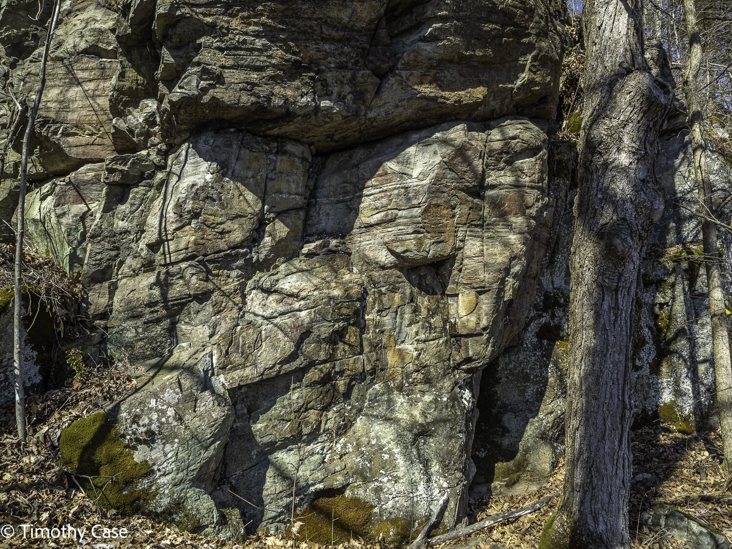
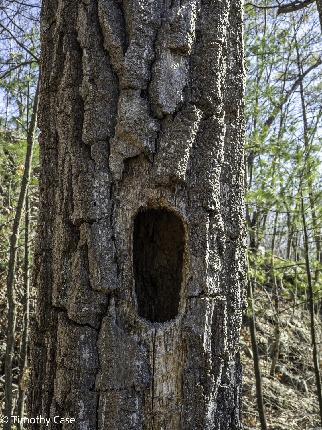
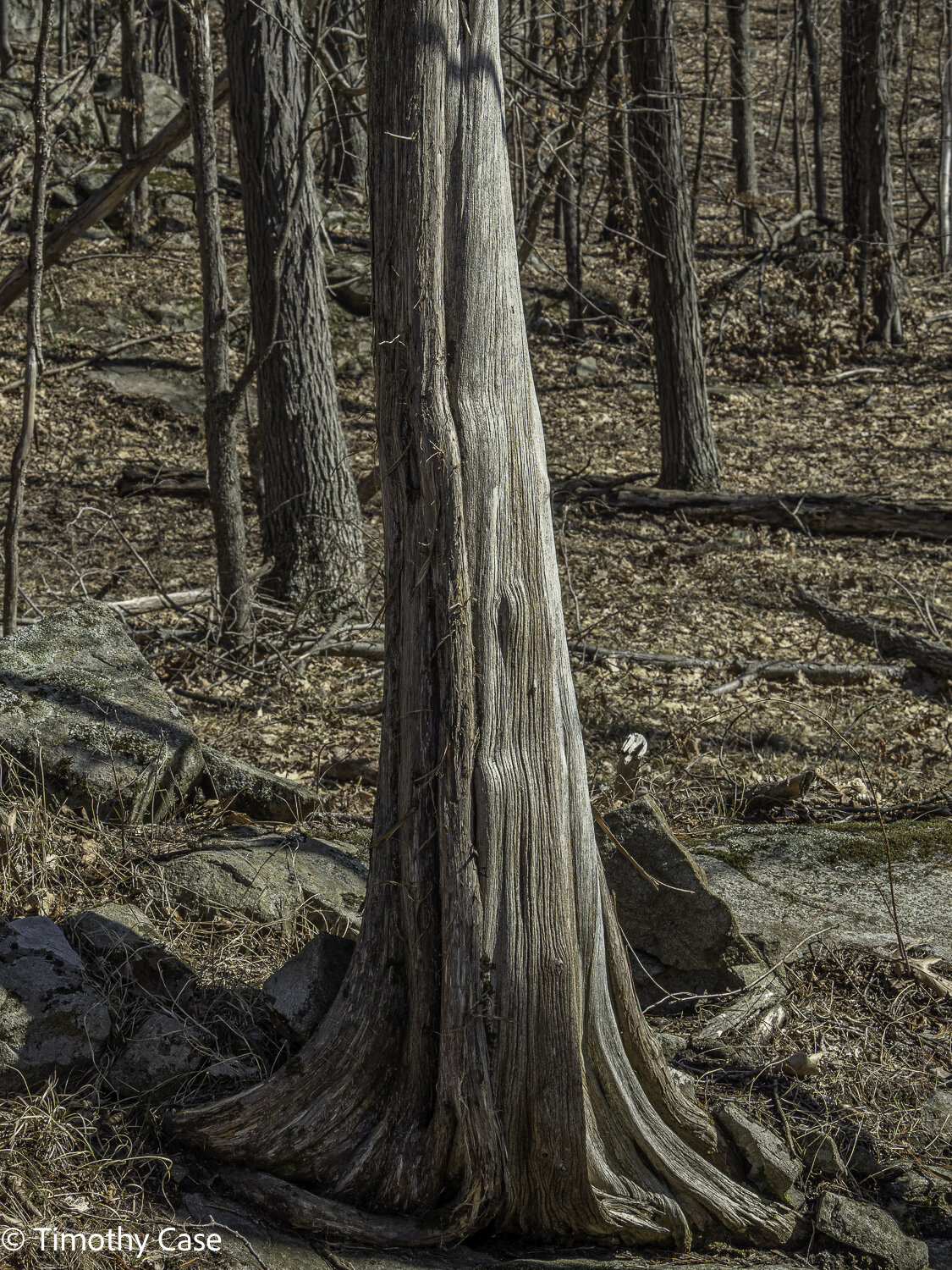
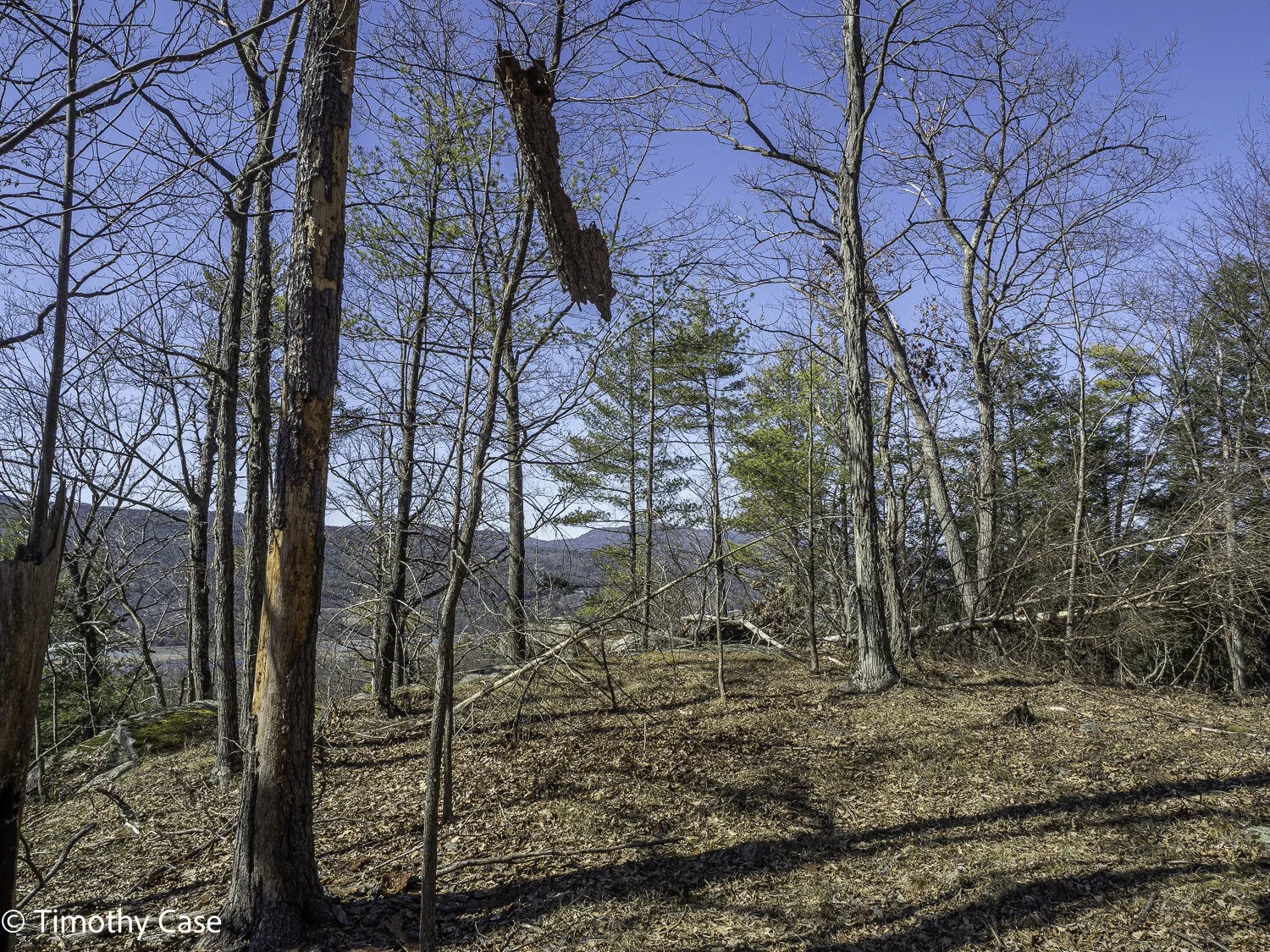
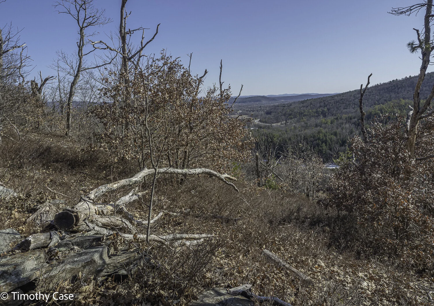
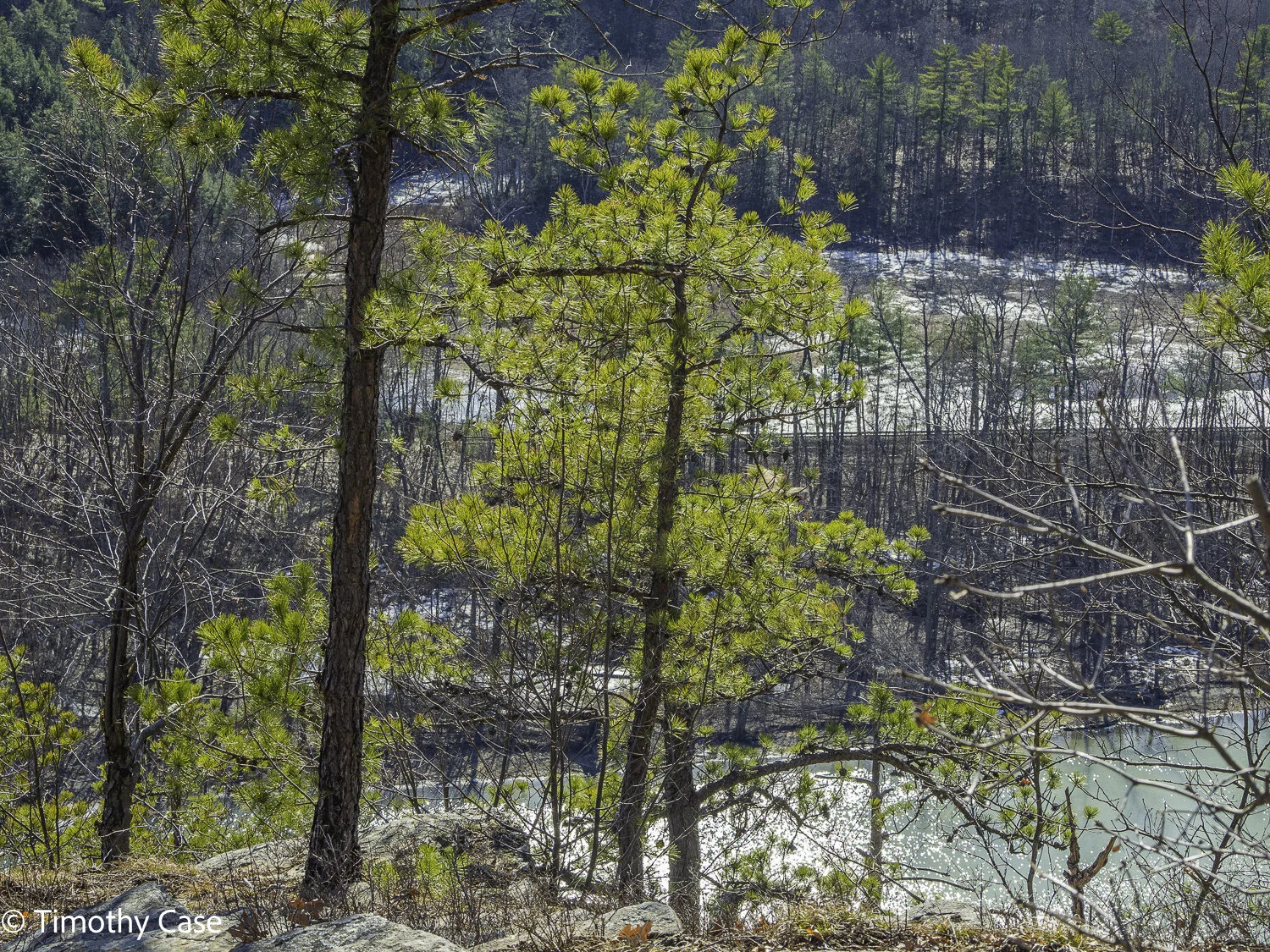
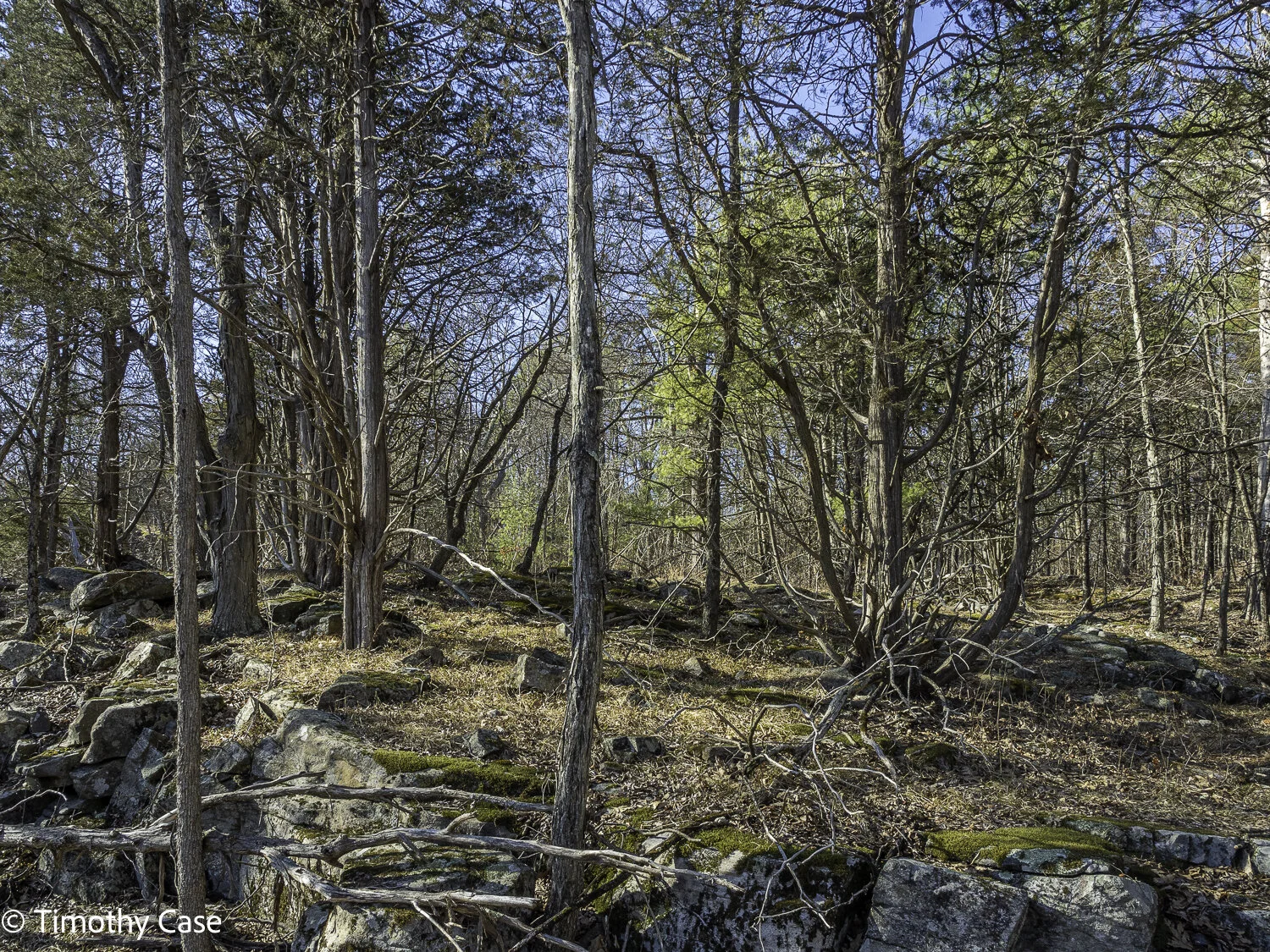
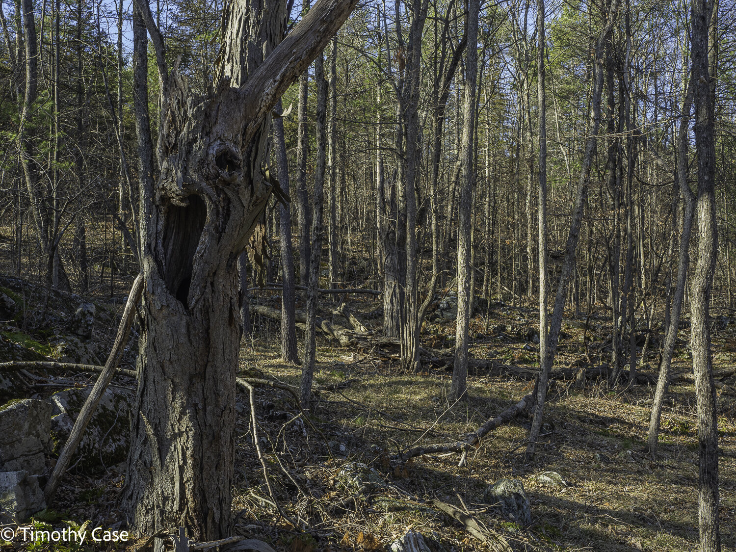
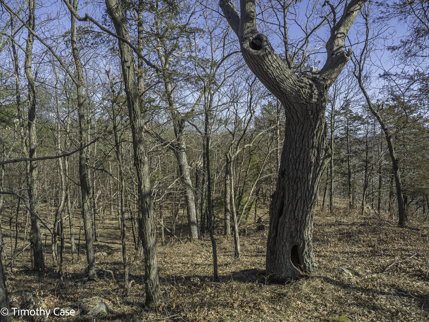
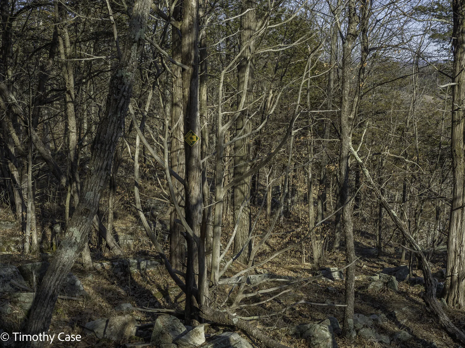
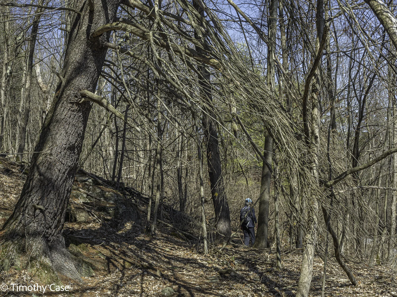
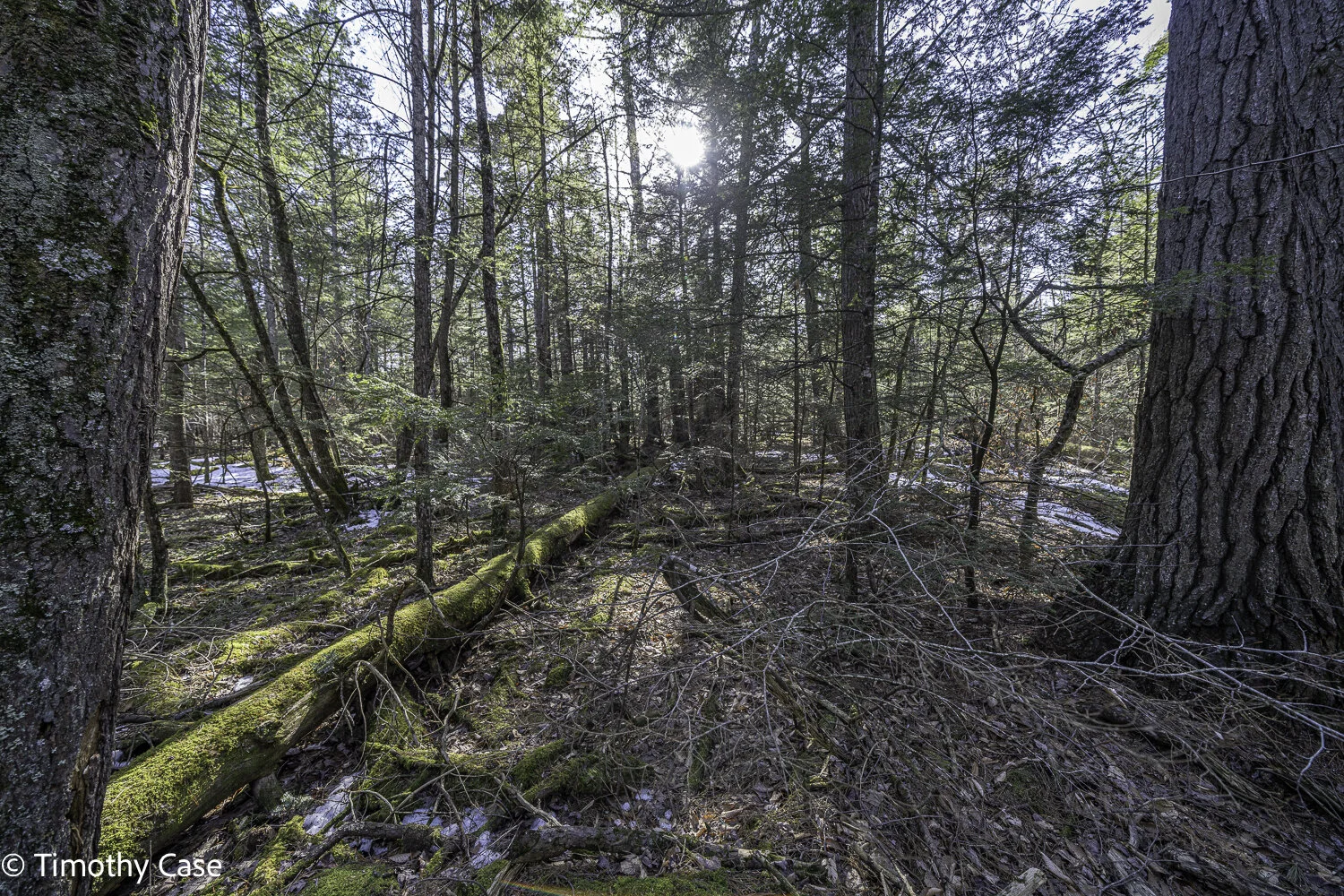
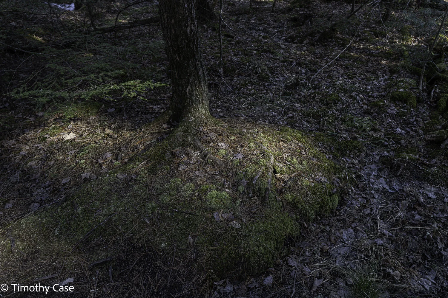
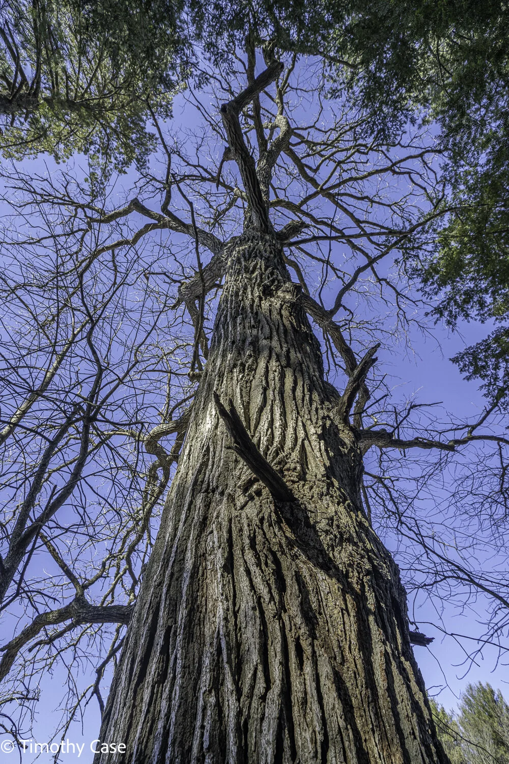
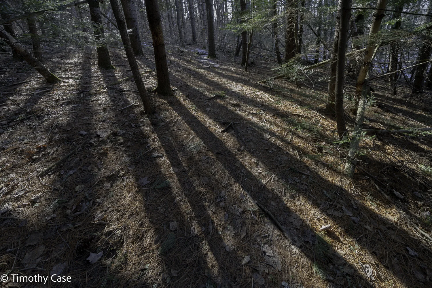
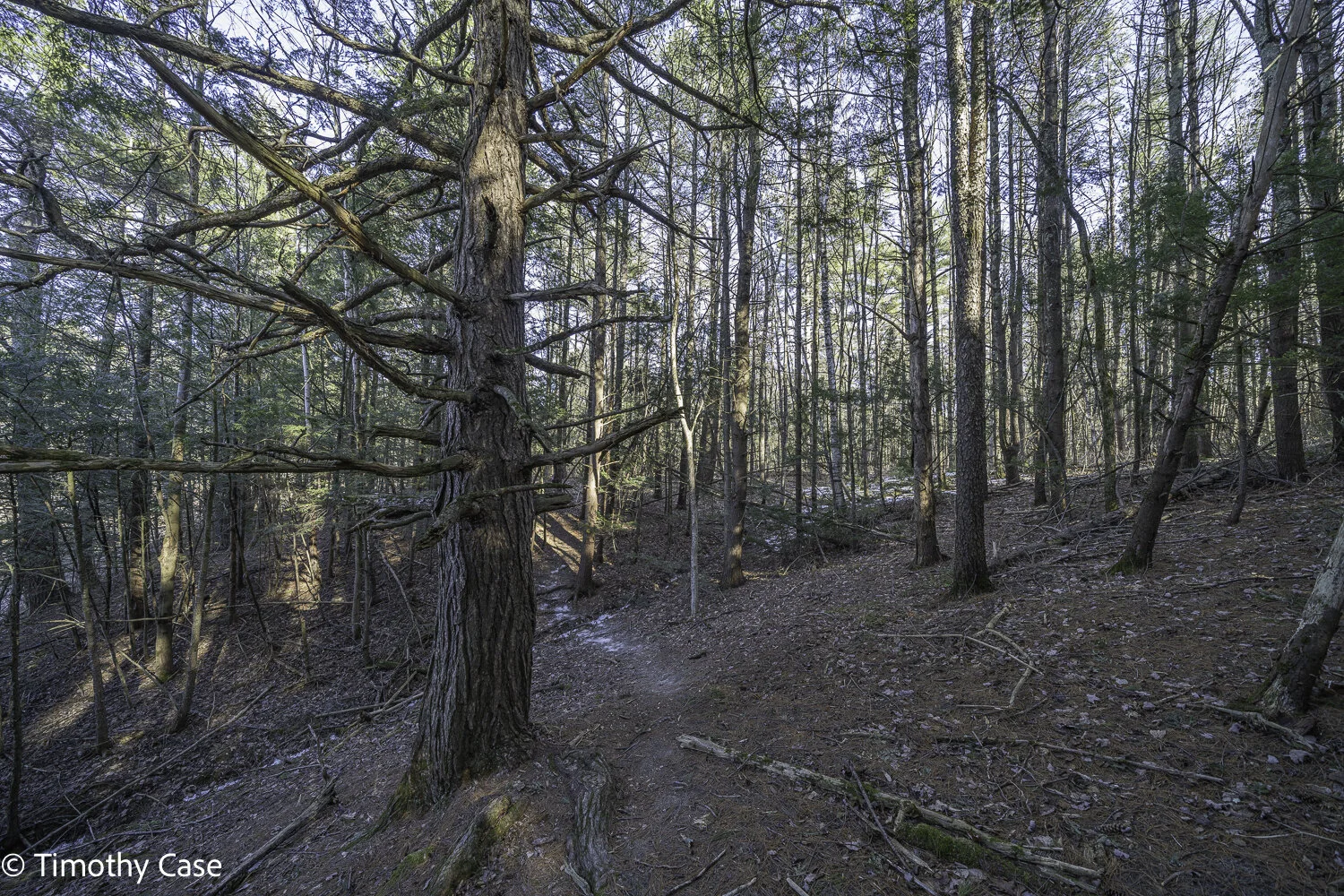
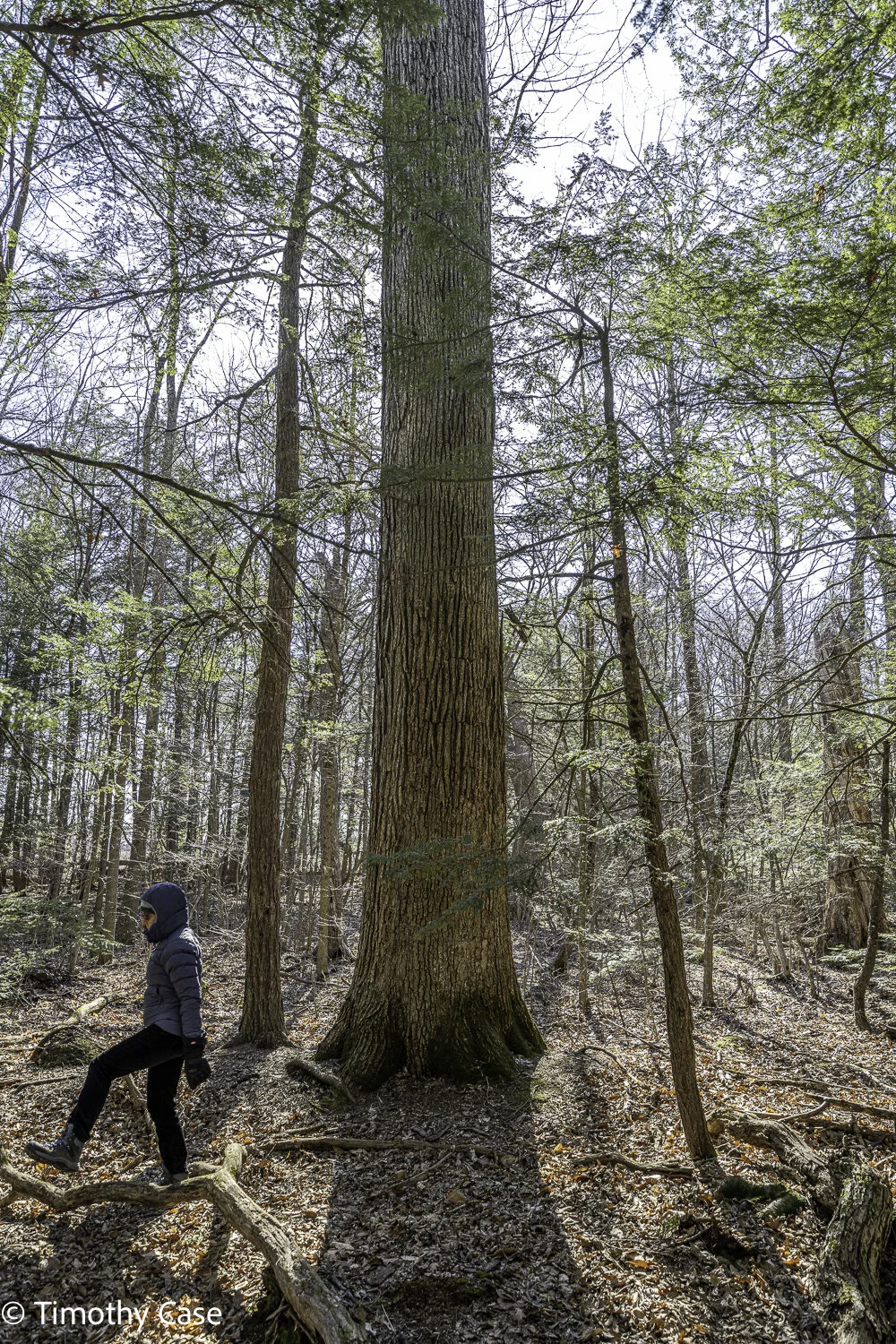
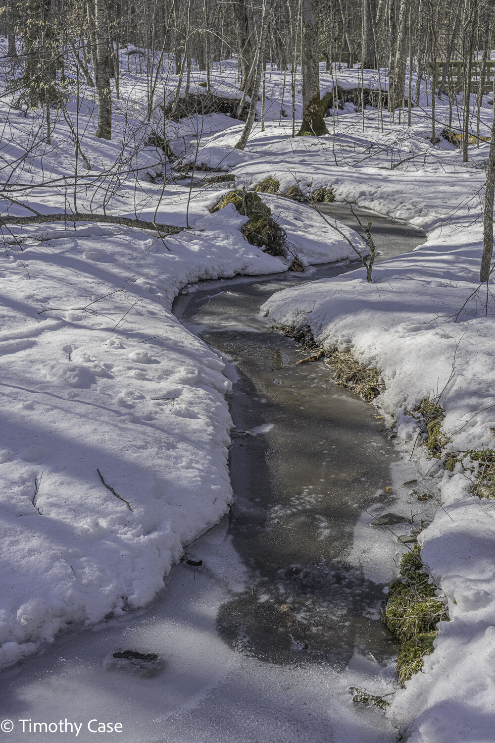
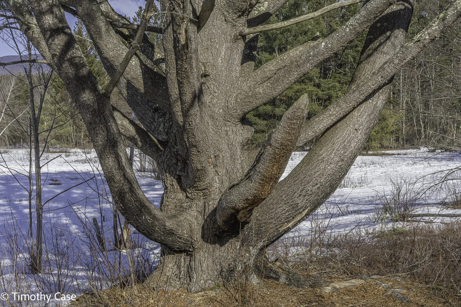
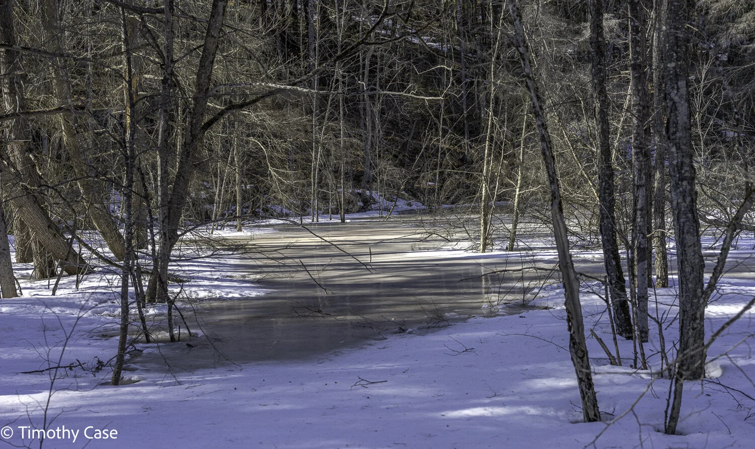
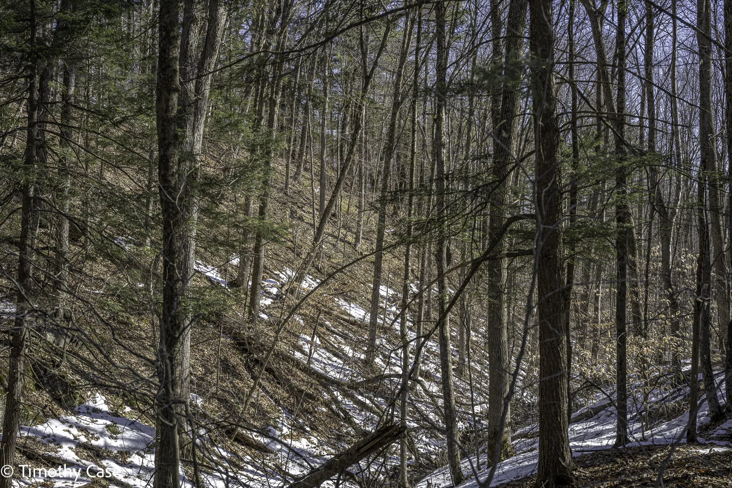
Along the fields along the first 1/2 mile of trail, there is a view of the cliffs on one side and a vista of mountains and wetlands on the other side. The cliffs of Bald Mountain jut abruptly and there are talus slopes. The trail splits just past the cliffs and connects again a mile on and continues to the top with a magnificent view of South Bay and Saddles Mountain in New York. On the way up, we took the inner, wooded trail and the cliff-side trail down. At the summit, we ventured farther by following the connector trail that generally follows the ridge but meanders into the woods in places at times. We encountered some natural areas along the connector trail that are different from those along Tim’s Trail, including a wonderful area dominated by chestnut oaks and a couple of still icy marsh ponds. After having hiked smooth and clearly identifiable snow covered trails for several months, we found the rocky trail challenging and faintly visible in places, but fortunately the trail is well marked so finding the trail again is easy. The old in the area along the cliff are old and exposed to high winds and the trees are smaller and fewer for it and there’s a lot of sedge underneath. Back away from the exposed cliffs, the trees are bigger, with some really large old specimens. Another area on the ridgeline part of Tim’s Trail has a section of large, old eastern red cedars. Most of the forest near the cliff is mixed with a lot of snags and downed trees typical of older forests.
I regularly strayed off the trail to see and photograph some spectacular views, interesting forest landscapes or a large specimen, something I wouldn’t do when the rattlesnakes are out of their dens from May to mid-October. Wearing high leather boots is an answer if you’ve got them.
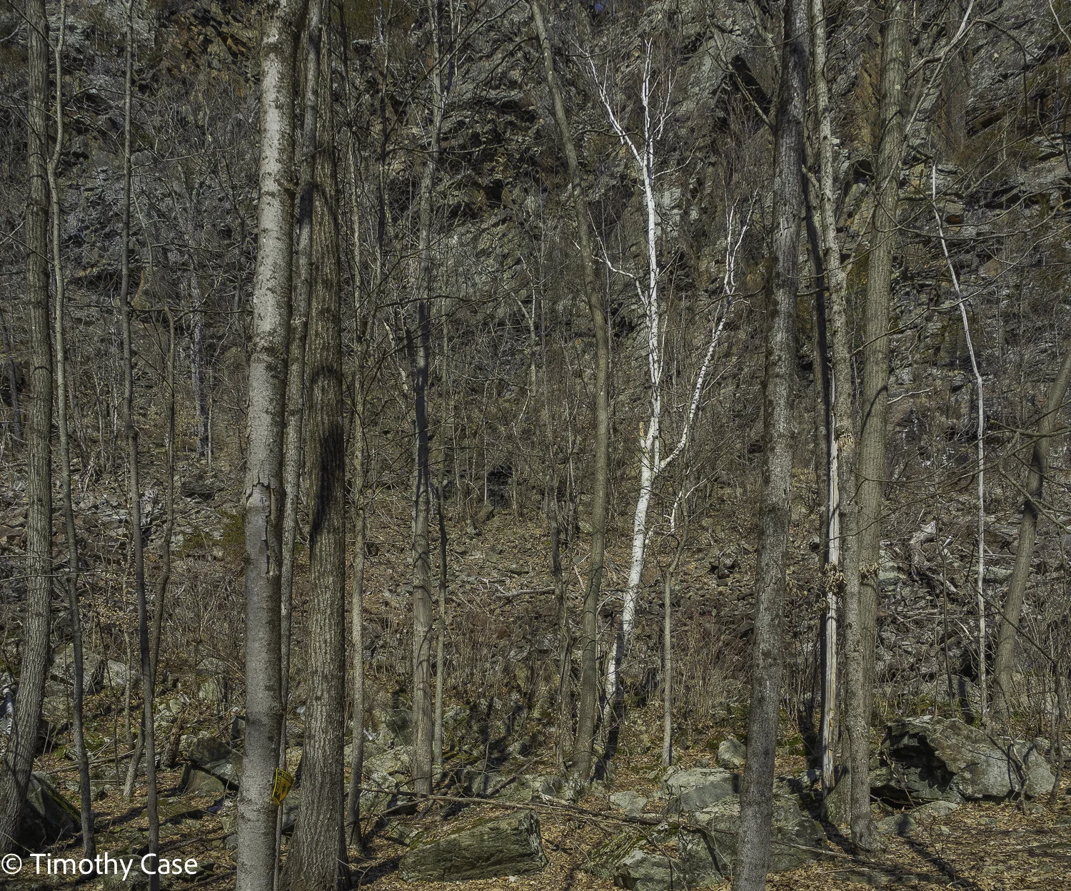
Tim’s Trail is flat along the first ½ mile and includes options through the rocky area next to the cliff and the smoother terrain beyond the trees along the field.
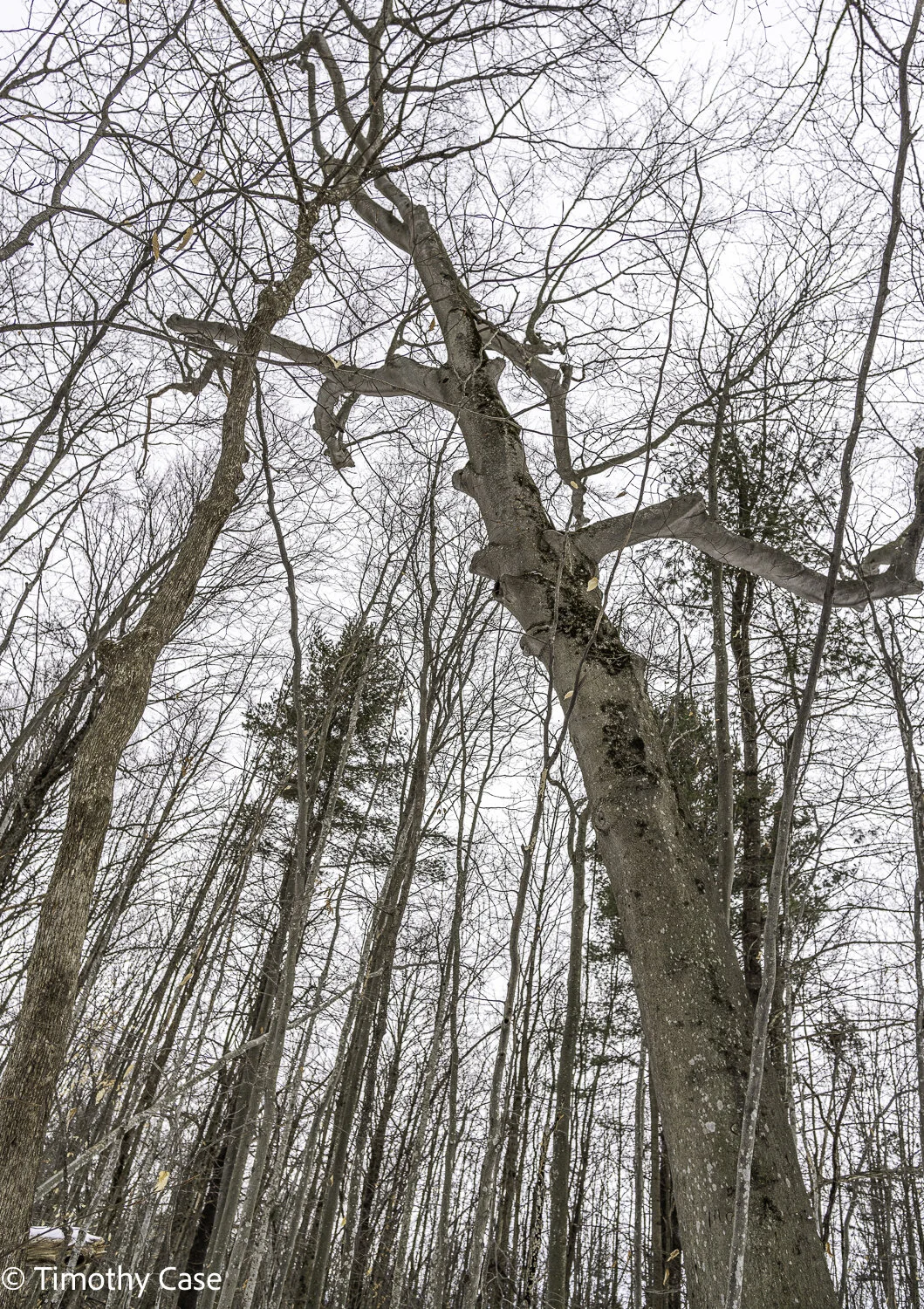
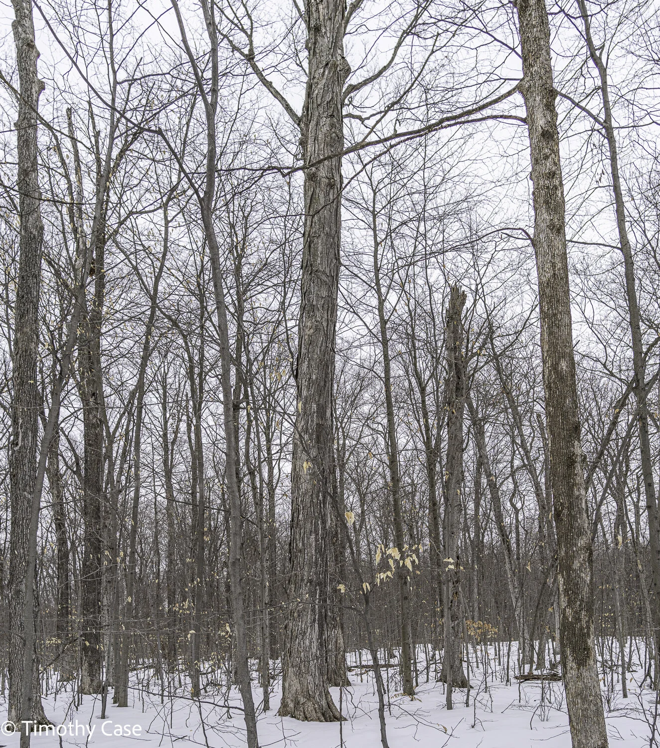
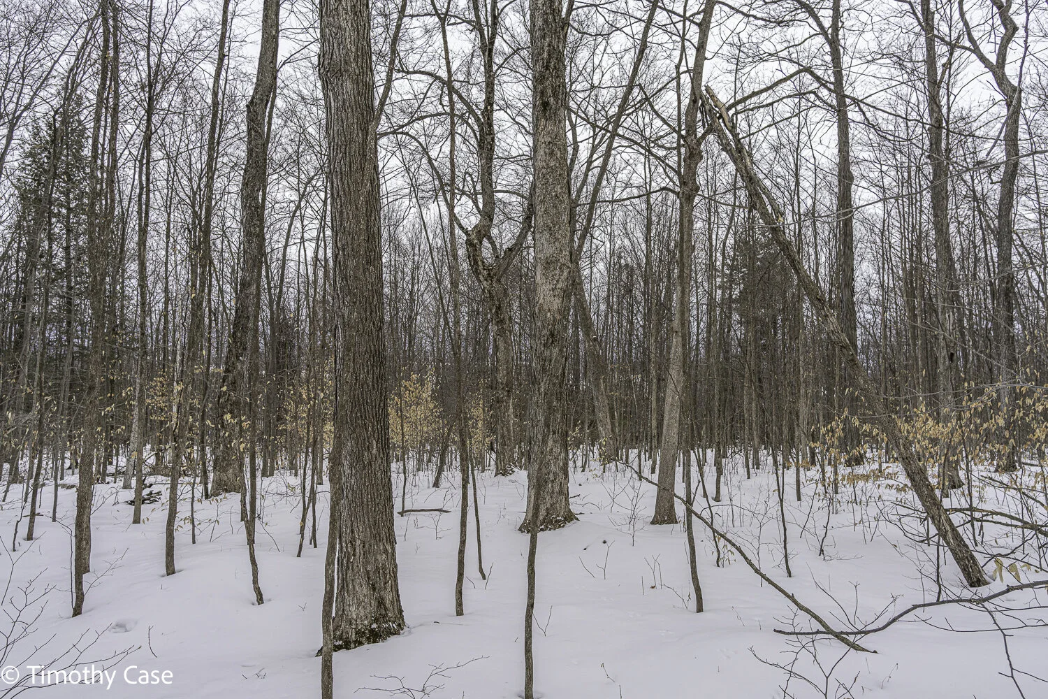
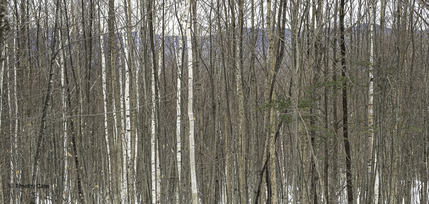
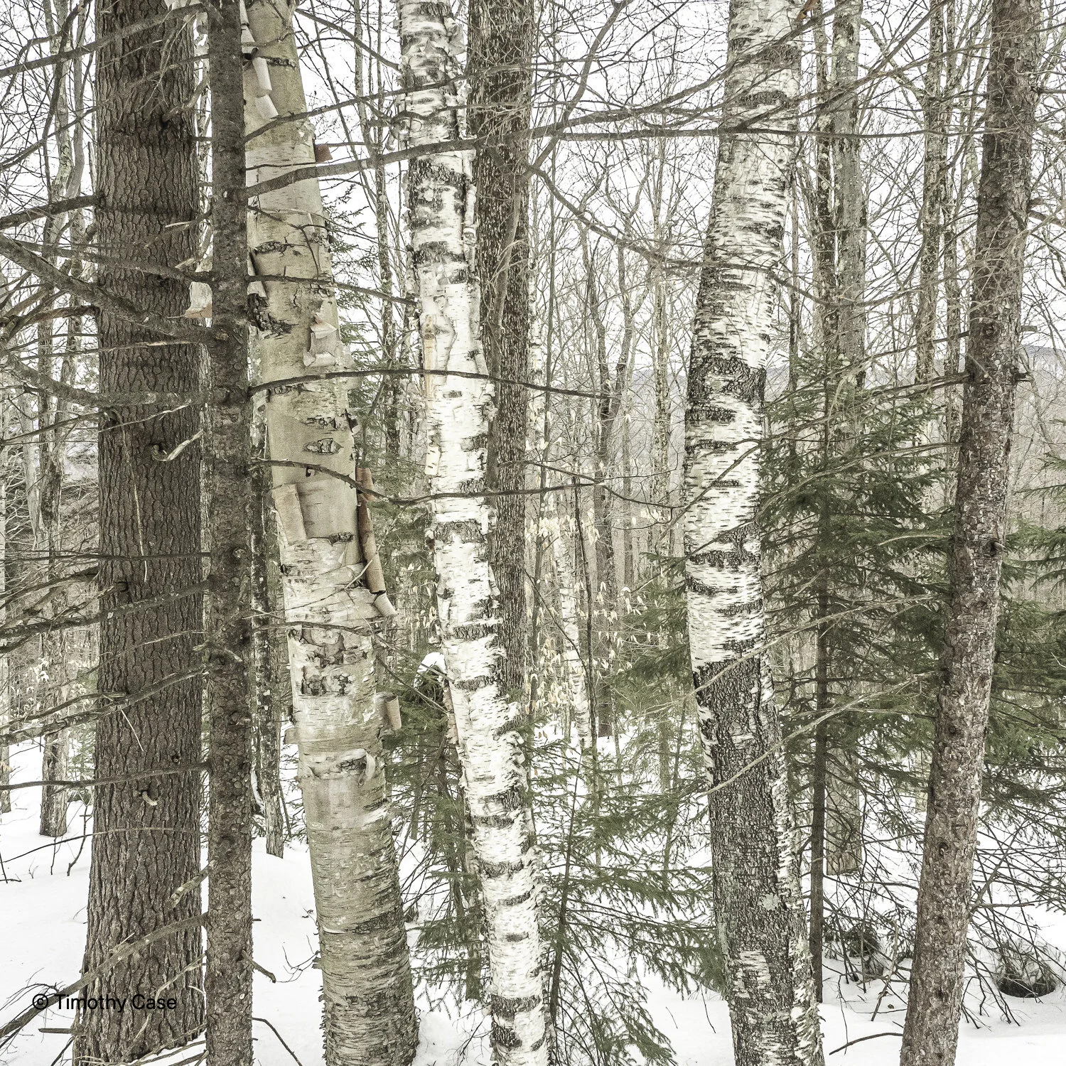
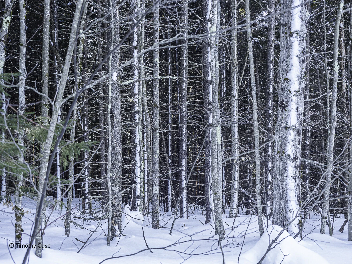
Helen Bruckner Natural Area/Bald Mountain, March 22, 2021
Olympus M5II & Olympus 12-45 f4
Helen Bruckner Natural Area/Bald Mountain, March 22, 2021
Olympus M5II & Olympus 12-45 f4
Helen Bruckner Natural Area/Bald Mountain, March 22, 2021
Olympus M5II & Olympus 12-45 f4
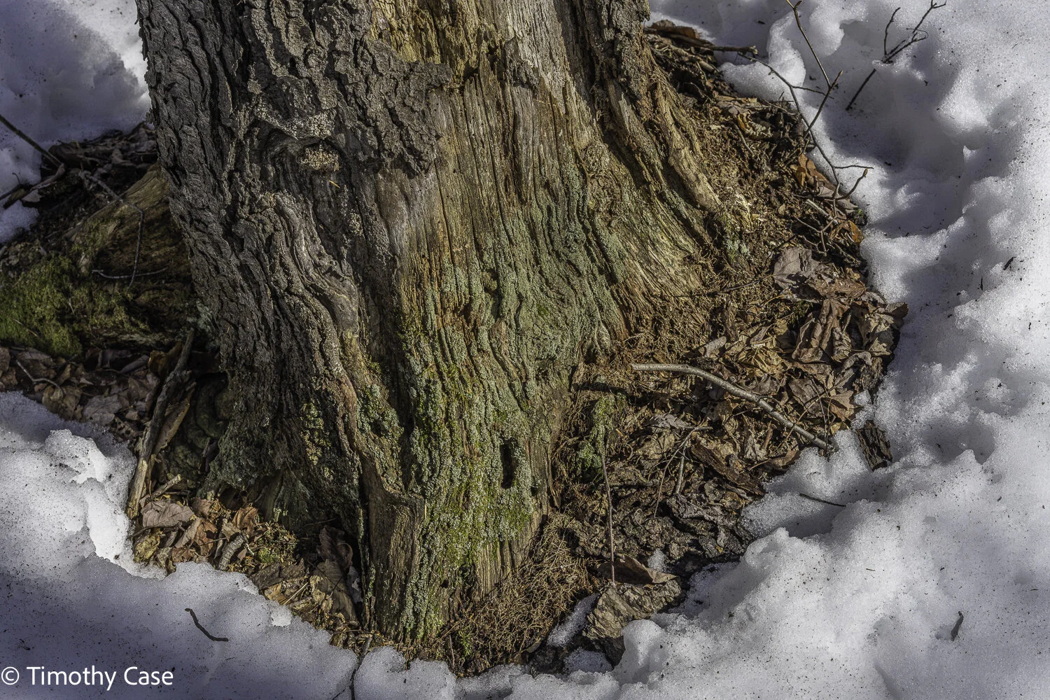
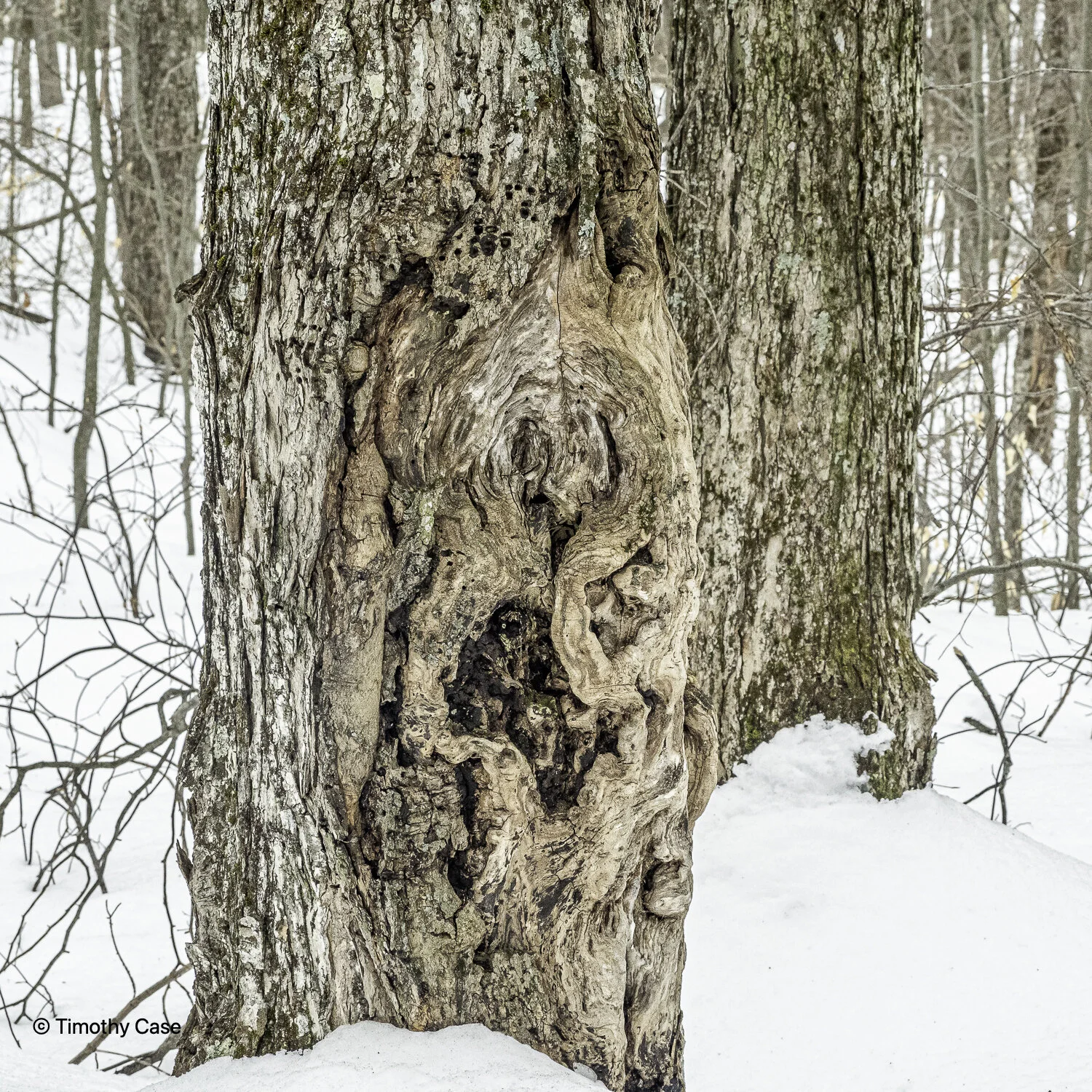
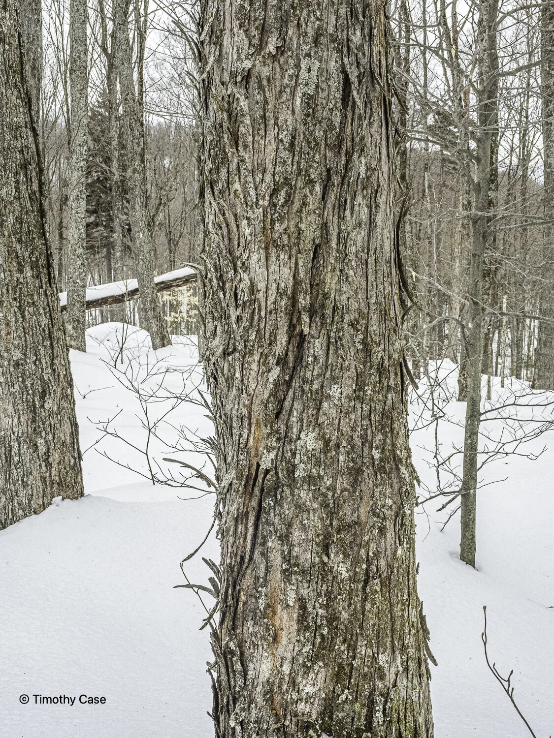
The base of the cliff face.
Helen Bruckner Natural Area/Bald Mountain, March 22, 2021
Olympus M5II & Olympus 12-45 f4
Helen Bruckner Natural Area/Bald Mountain, March 22, 2021
Olympus M5II & Olympus 12-45 f4
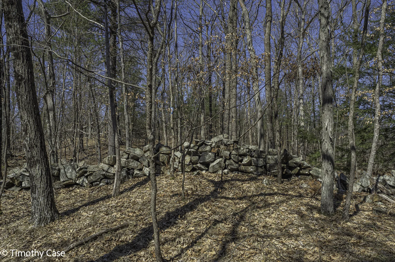
The area away from the cliffs was cleared of stones for agricultural, including sheep grazing, no doubt given the difficulty of growing crops on this steep terrain. Astoundingly, this stone wall continues for a mile.
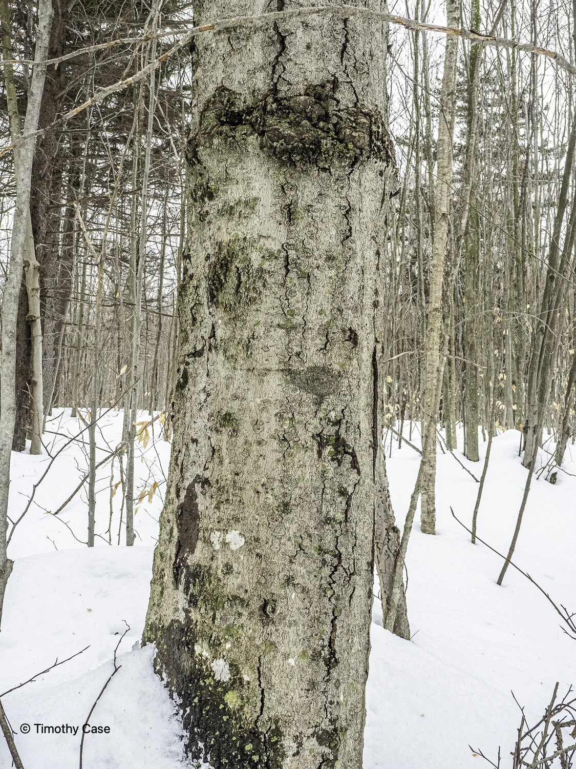
Helen Bruckner Natural Area/Bald Mountain, March 22, 2021
Olympus M5II & Olympus 12-45 f4
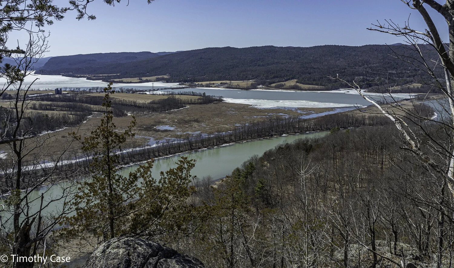
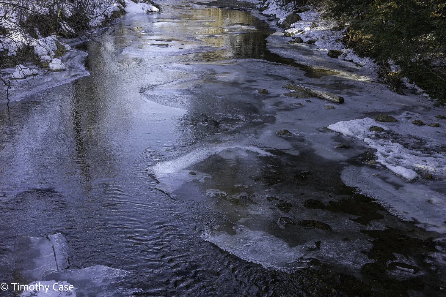
South Bay, Poultney River
Helen Bruckner Natural Area/Bald Mountain, March 22, 2021
Olympus M5II & Olympus 12-45 f4
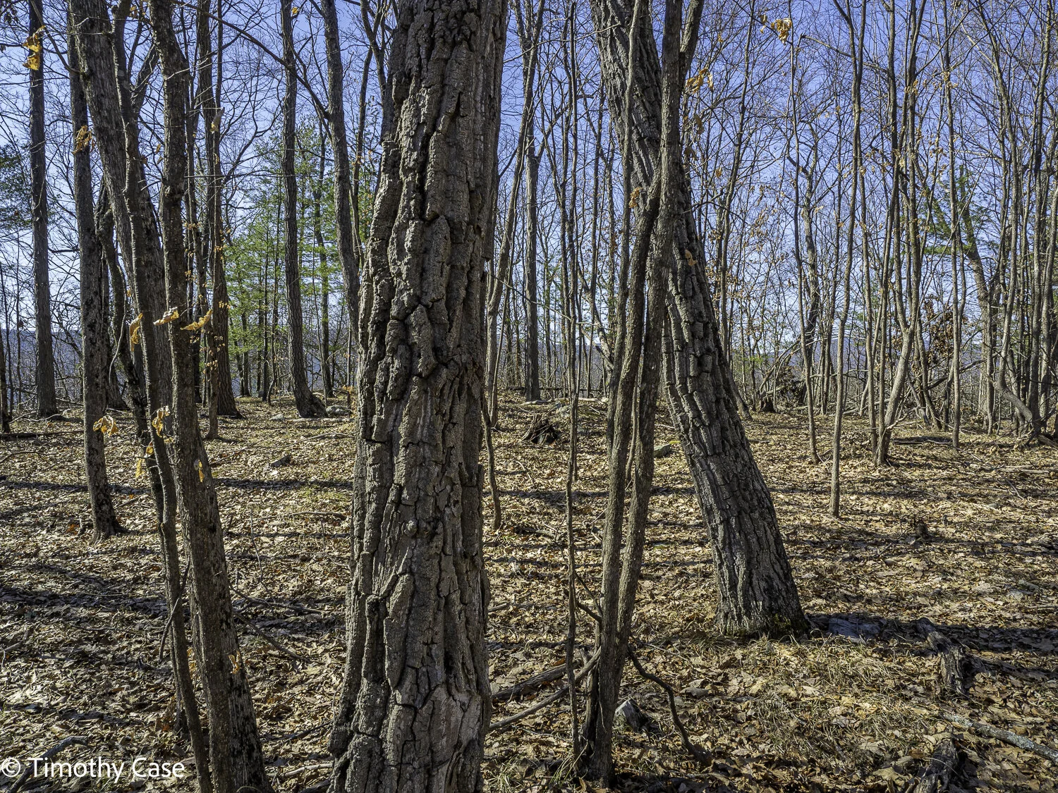
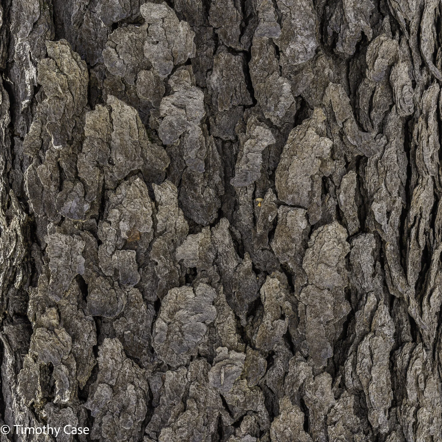
Area of the forest dominated by chestnut oaks.
Helen Bruckner Natural Area/Bald Mountain, March 22, 2021
Olympus M5II & Olympus 12-45 f4
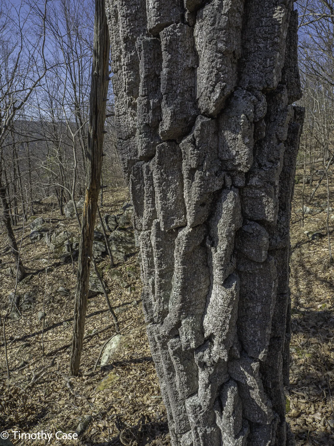
Close up of the bark of a chestnut oak.
Helen Bruckner Natural Area/Bald Mountain, March 22, 2021
Olympus M5II & Olympus 12-45 f4
Helen Bruckner Natural Area/Bald Mountain, March 22, 2021
Olympus M5II & Olympus 12-45 f4
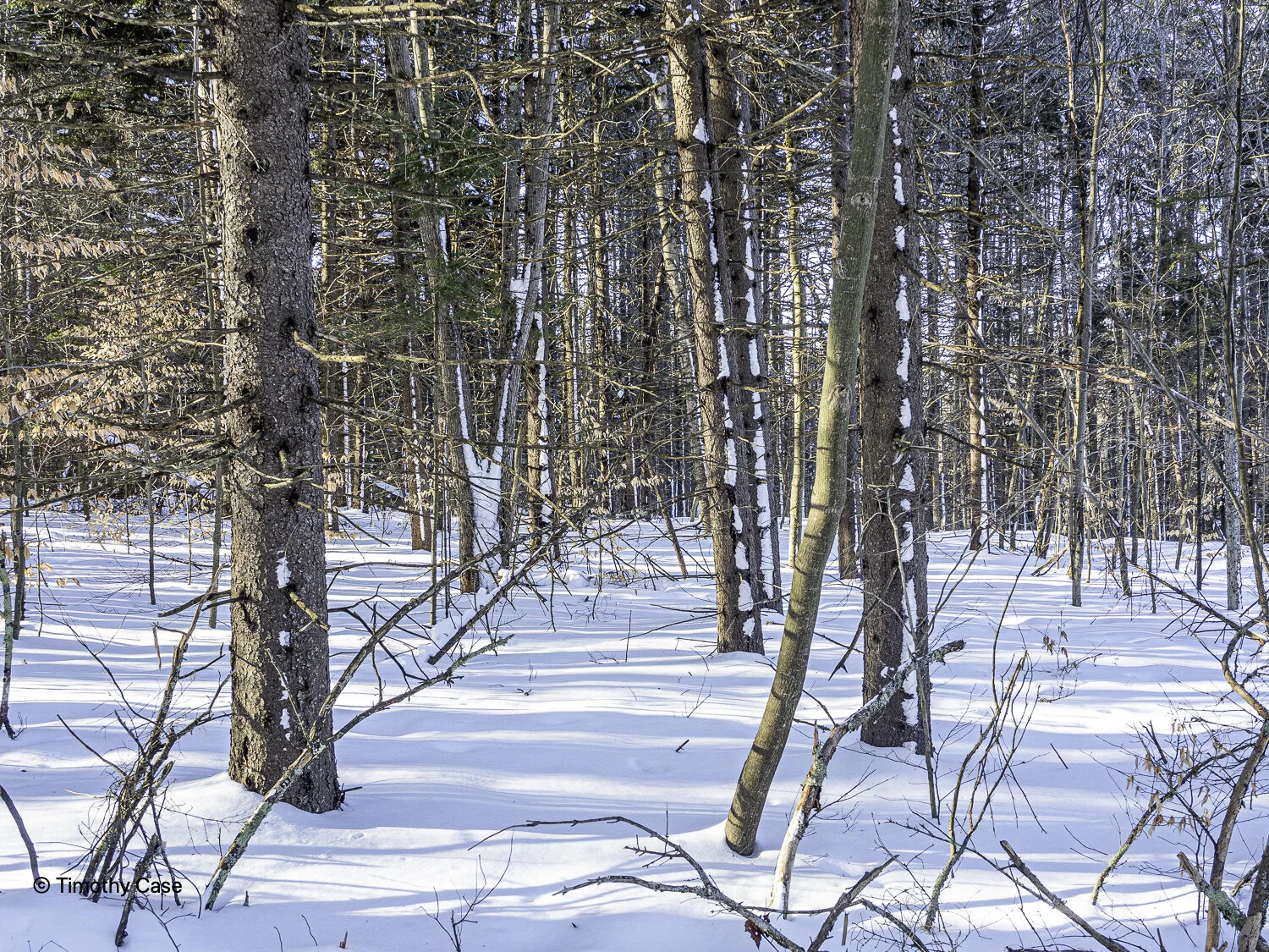
Helen Bruckner Natural Area/Bald Mountain, March 22, 2021
Olympus M5II & Olympus 12-45 f4
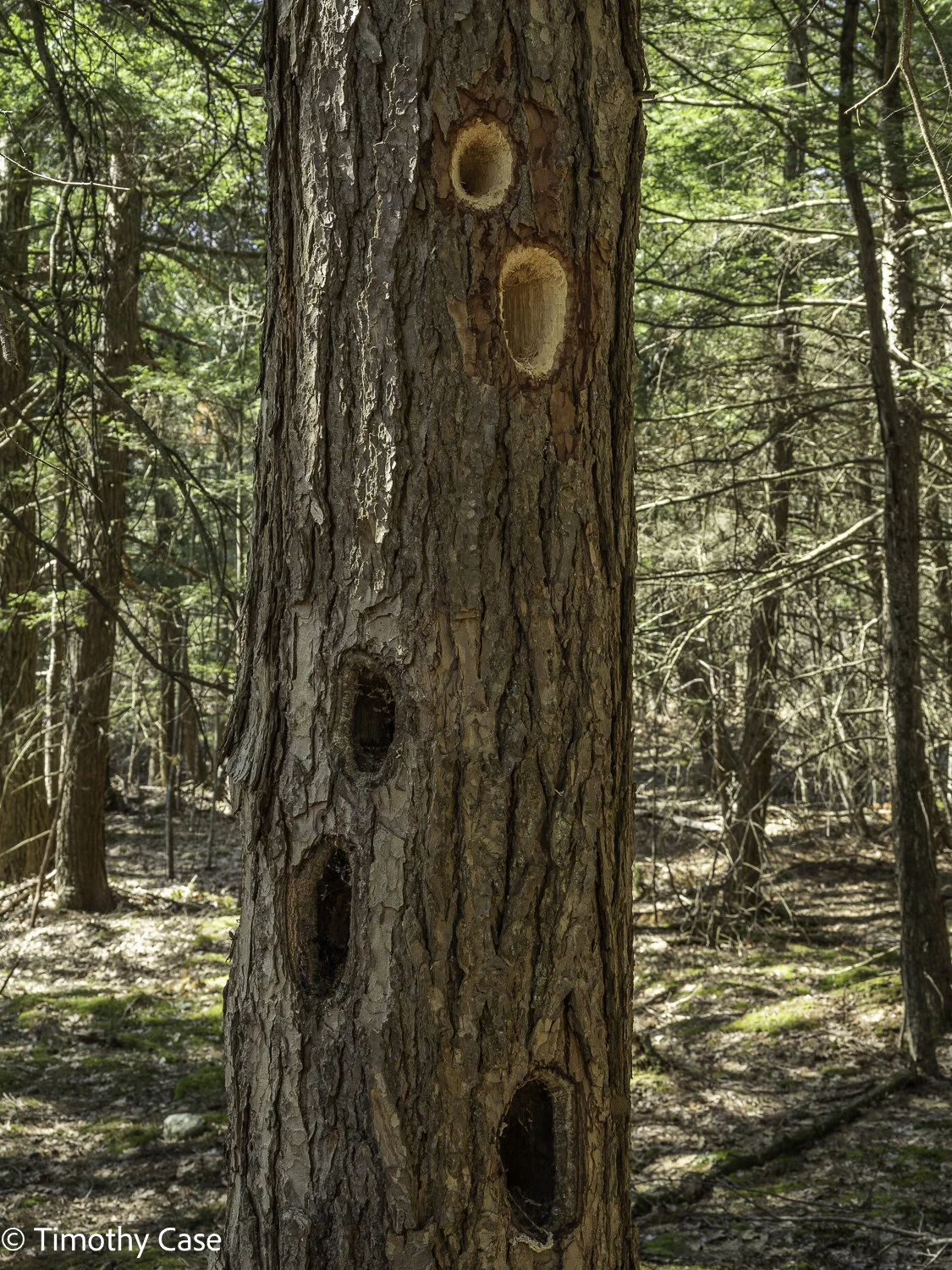
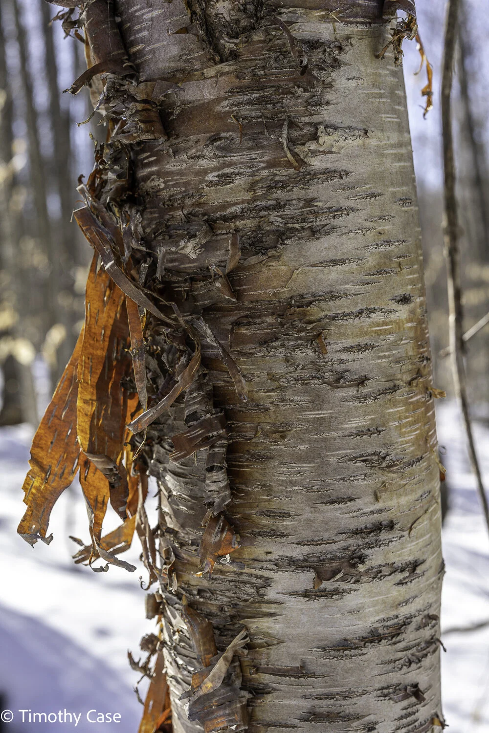
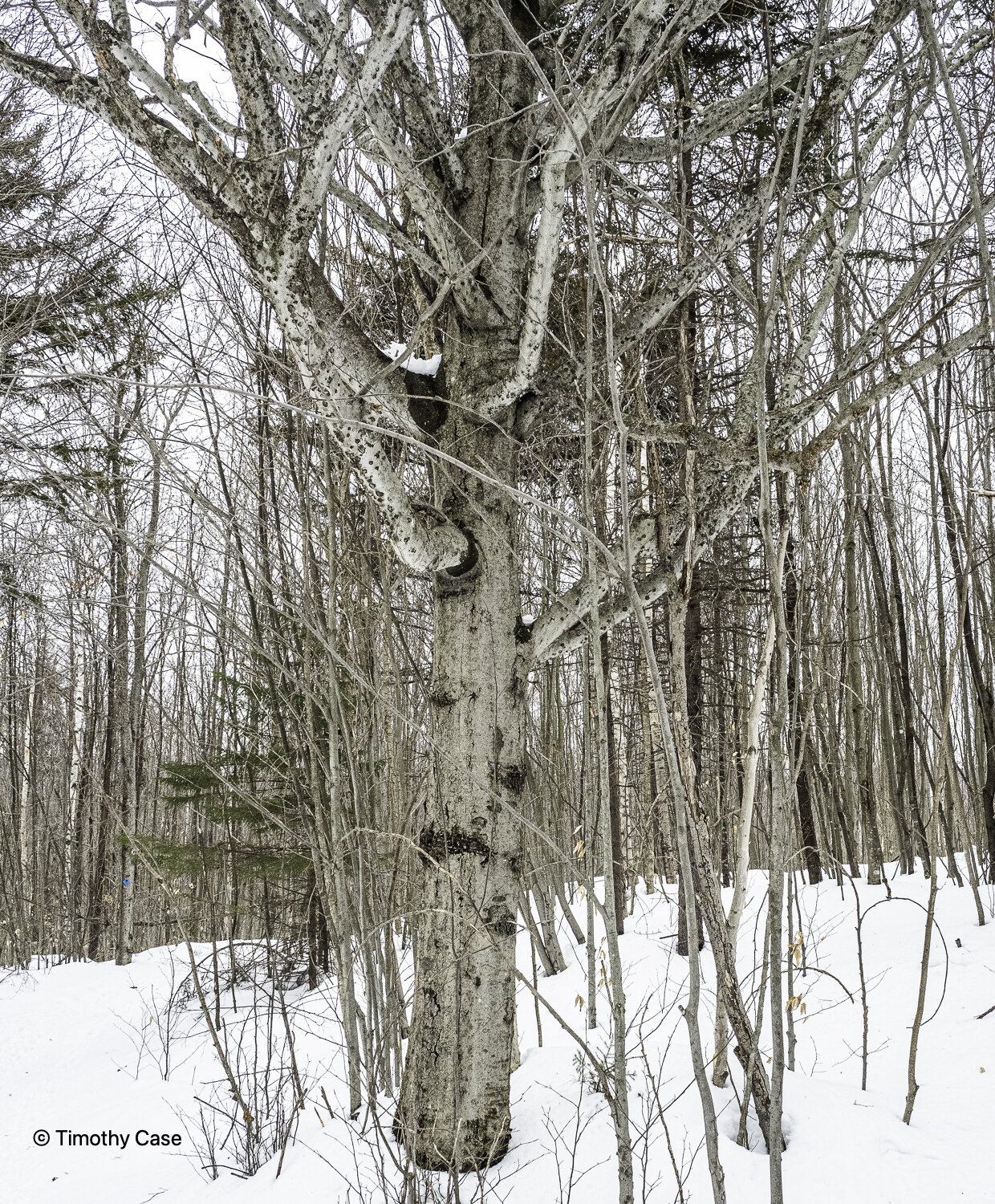
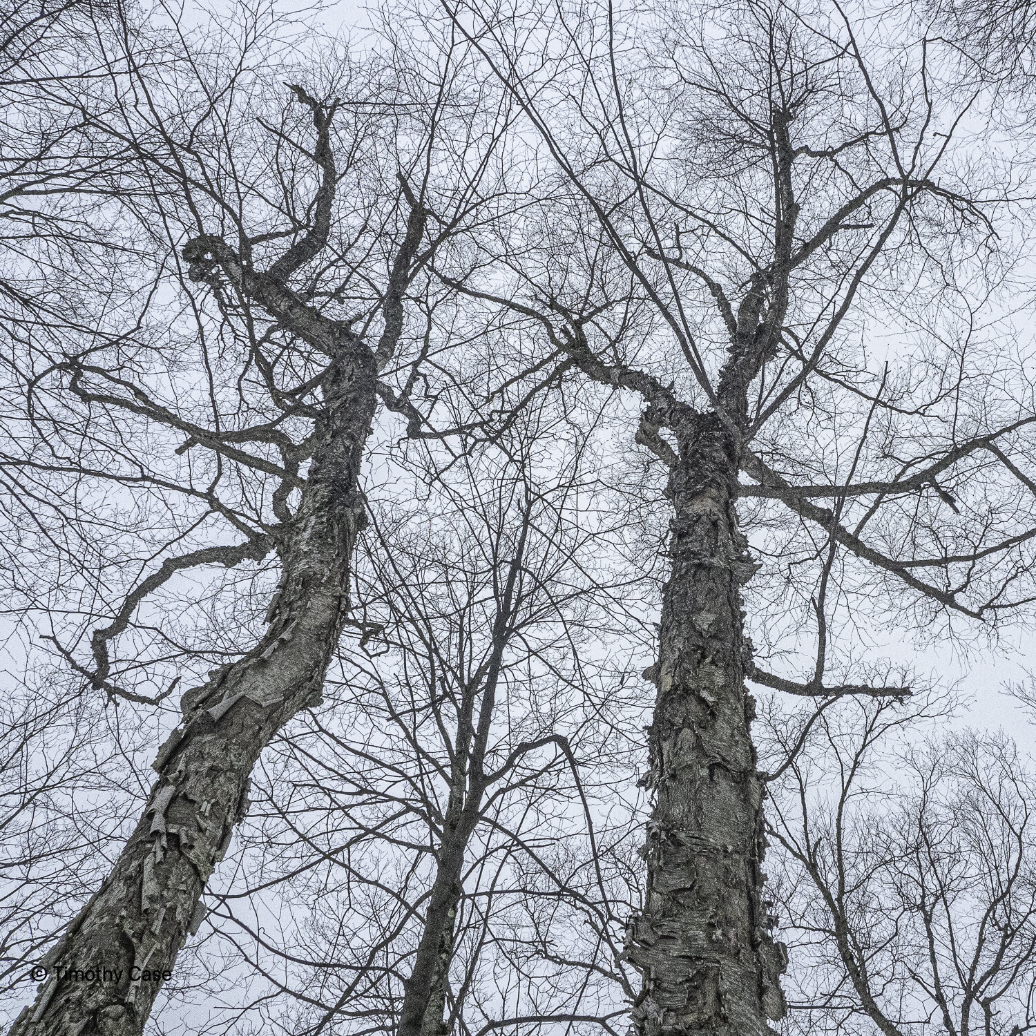
I mentioned that the wind was high up here…high enough, it seems, to blow the bark off trees!
Helen Bruckner Natural Area/Bald Mountain, March 22, 2021
Olympus M5II & Olympus 12-45 f4
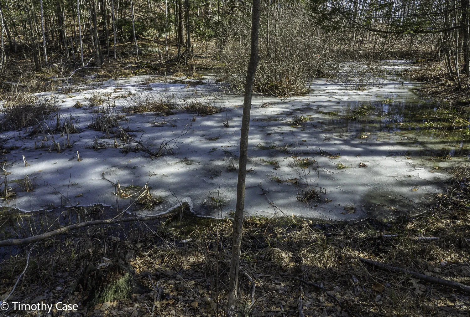
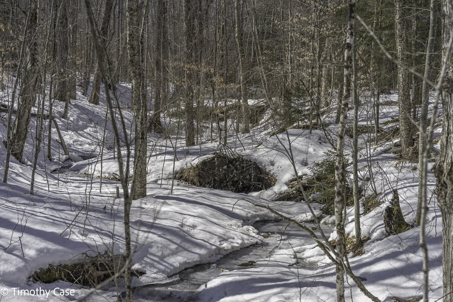
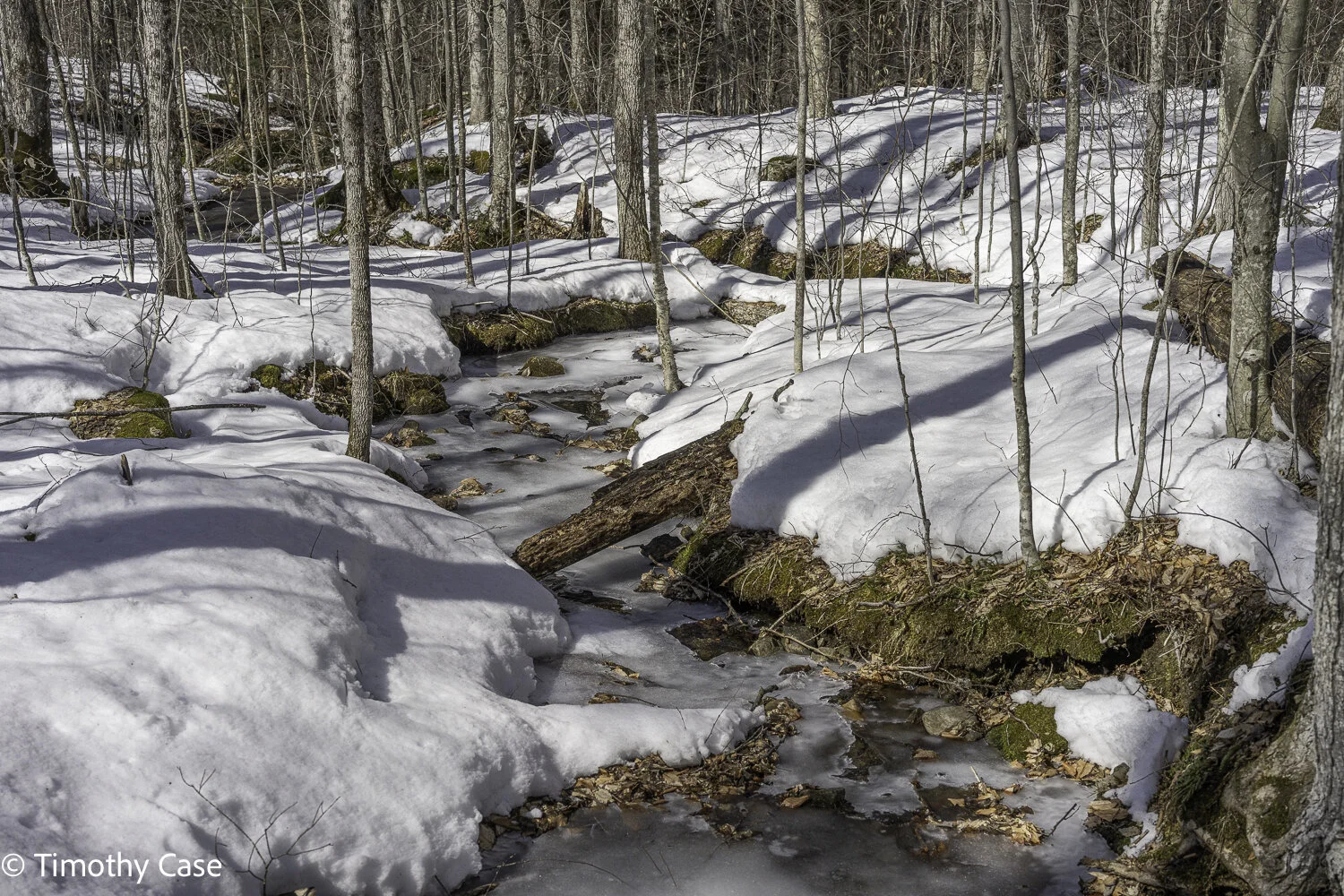
Still some snow & ice in shaded areas.
Helen Bruckner Natural Area/Bald Mountain, March 22, 2021
Olympus M5II & Olympus 12-45 f4
Helen Bruckner Natural Area/Bald Mountain, March 22, 2021
Olympus M5II & Olympus 12-45 f4
Poultny River
Helen Bruckner Natural Area/Bald Mountain, March 22, 2021
Olympus M5II & Olympus 12-45 f4
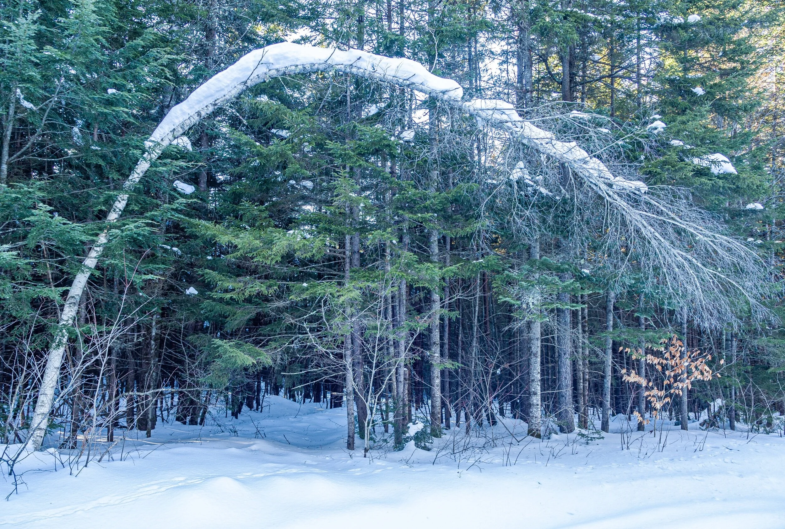
Helen Bruckner Natural Area/Bald Mountain, March 22, 2021
Olympus M5II & Olympus 12-45 f4
Helen Bruckner Natural Area/Bald Mountain, March 22, 2021
Olympus M5II & Olympus 12-45 f4
Helen Bruckner Natural Area/Bald Mountain, March 22, 2021
Olympus M5II & Olympus 12-45 f4
Helen Bruckner Natural Area/Bald Mountain, March 22, 2021
Olympus M5II & Olympus 12-45 f4
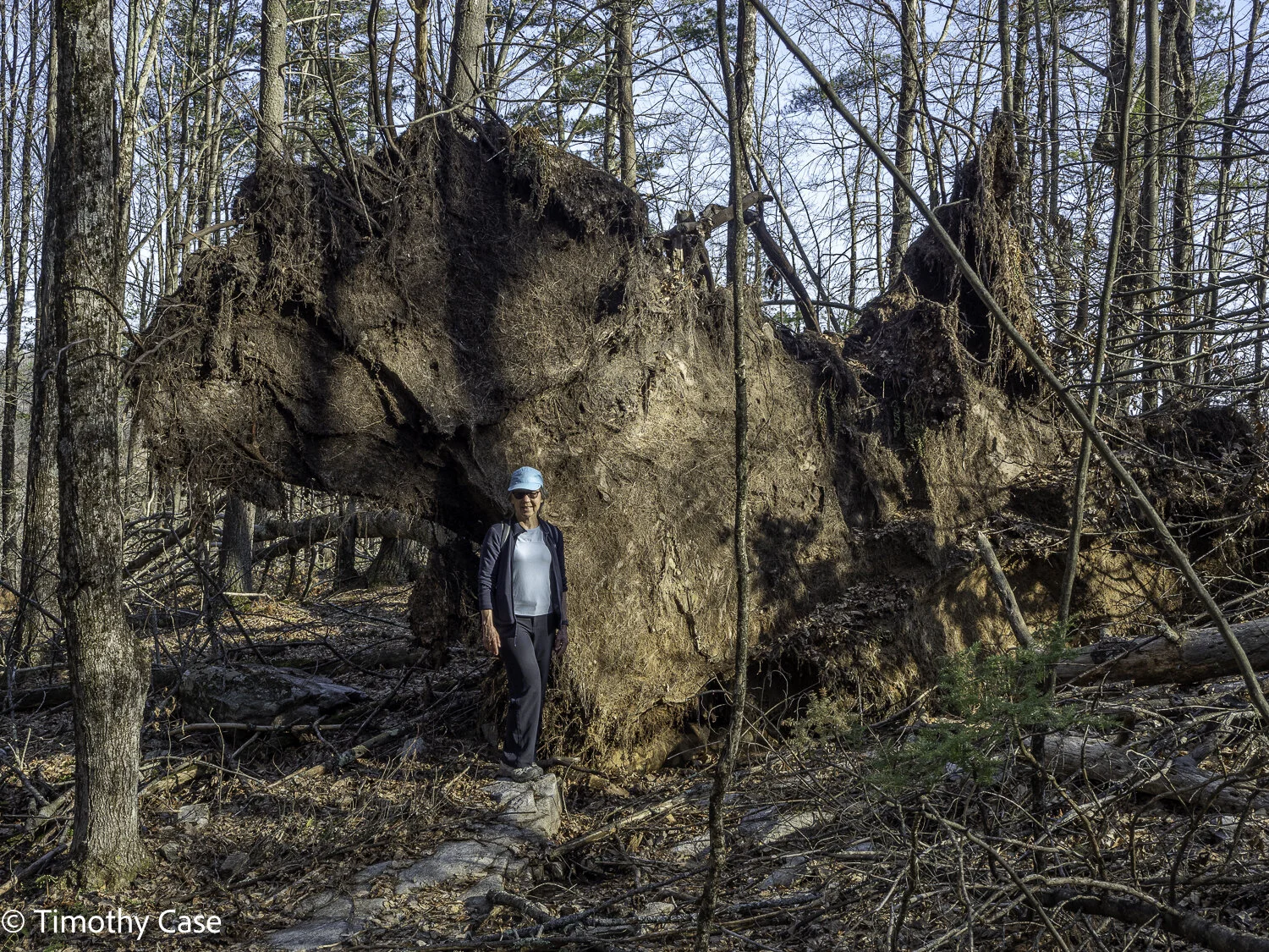
Massive tip up
Helen Bruckner Natural Area/Bald Mountain, March 22, 2021
Olympus M5II & Olympus 12-45 f4
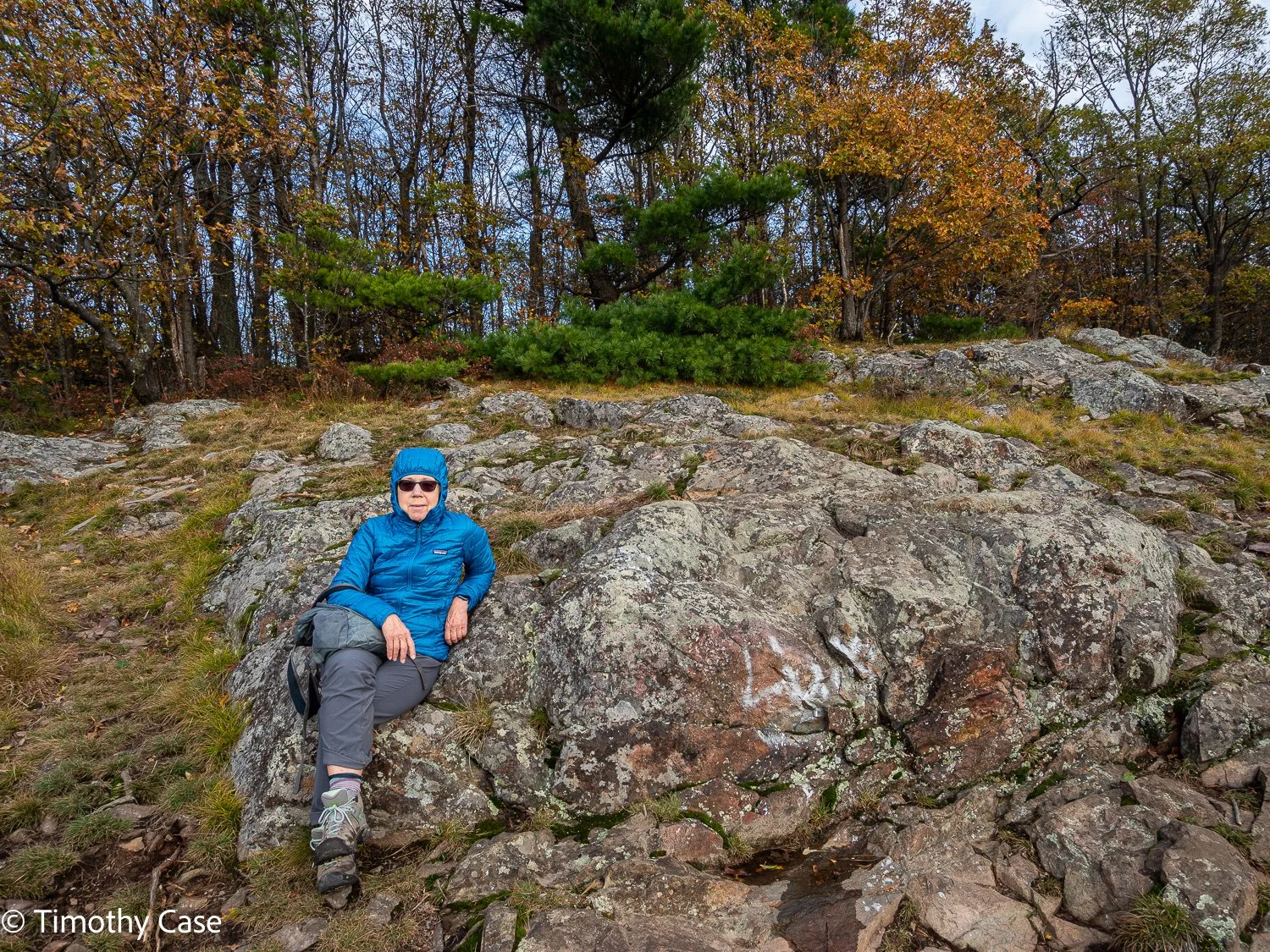
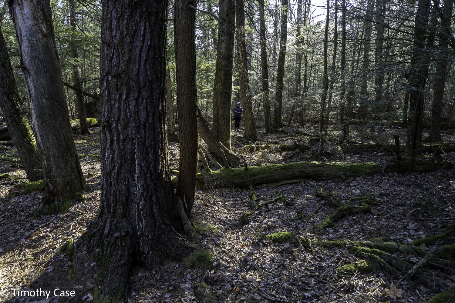
Barbara heading down the path from the summit of Bald Mountain.
Helen Bruckner Natural Area/Bald Mountain, March 22, 2021
Olympus M5II & Olympus 12-45 f4
Williams Woods
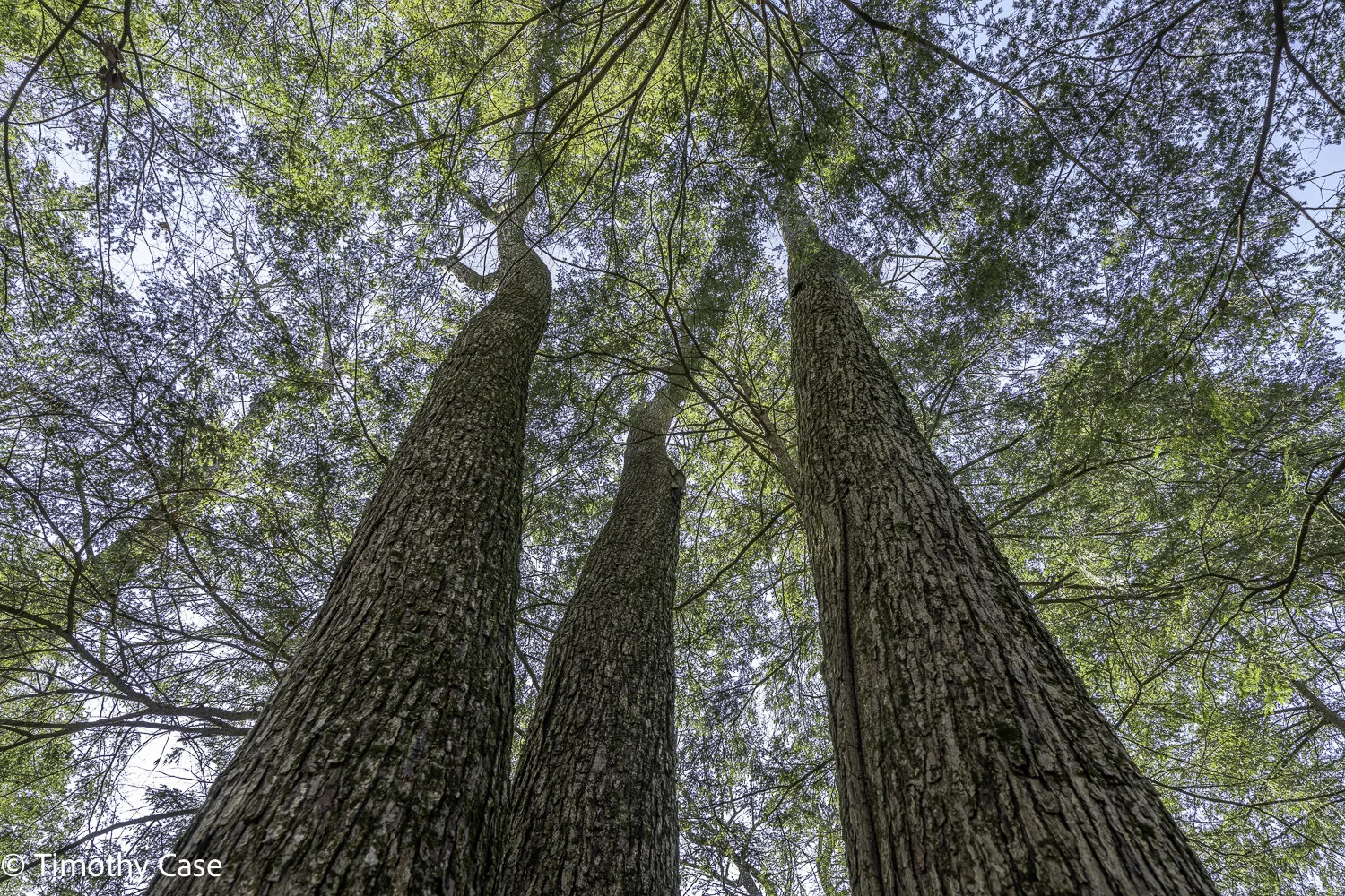
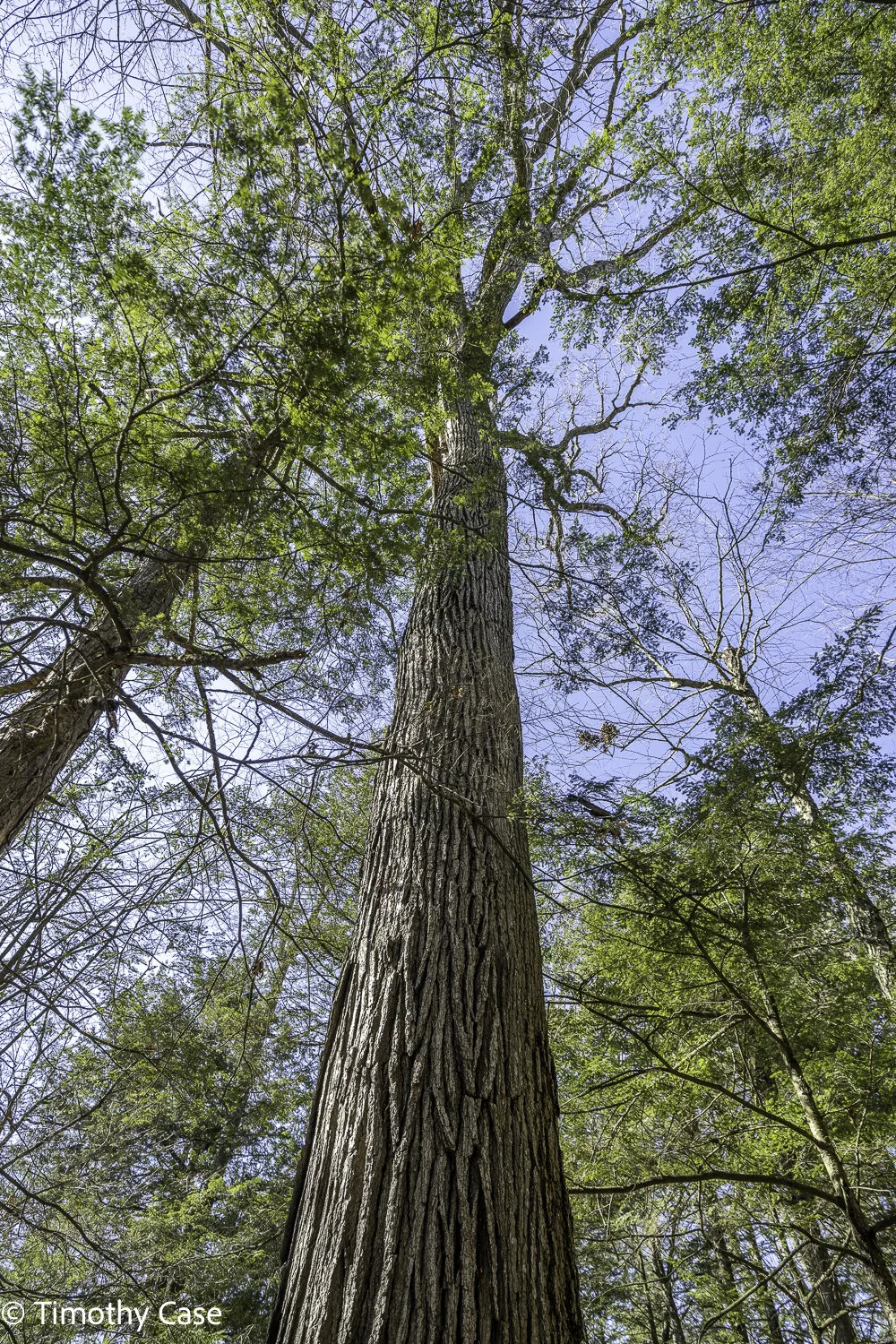
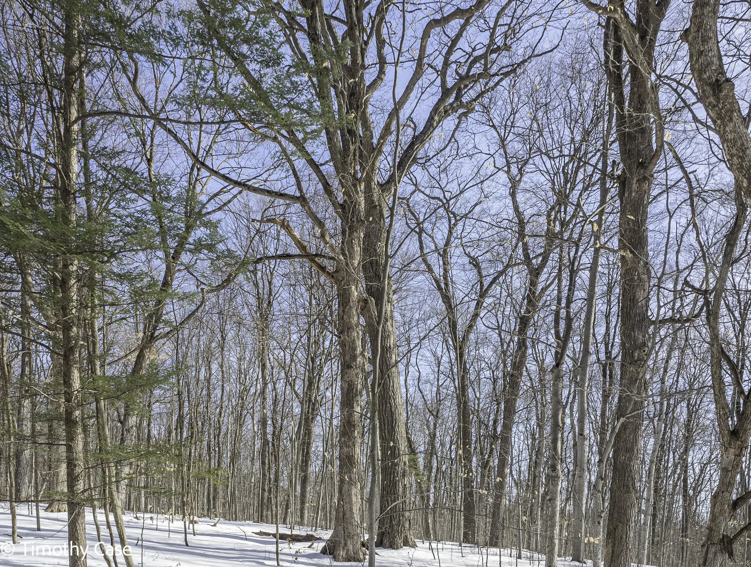
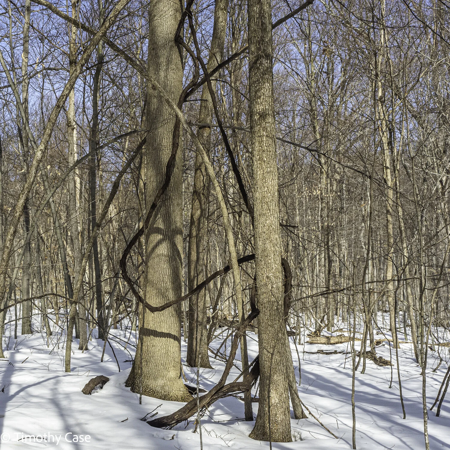
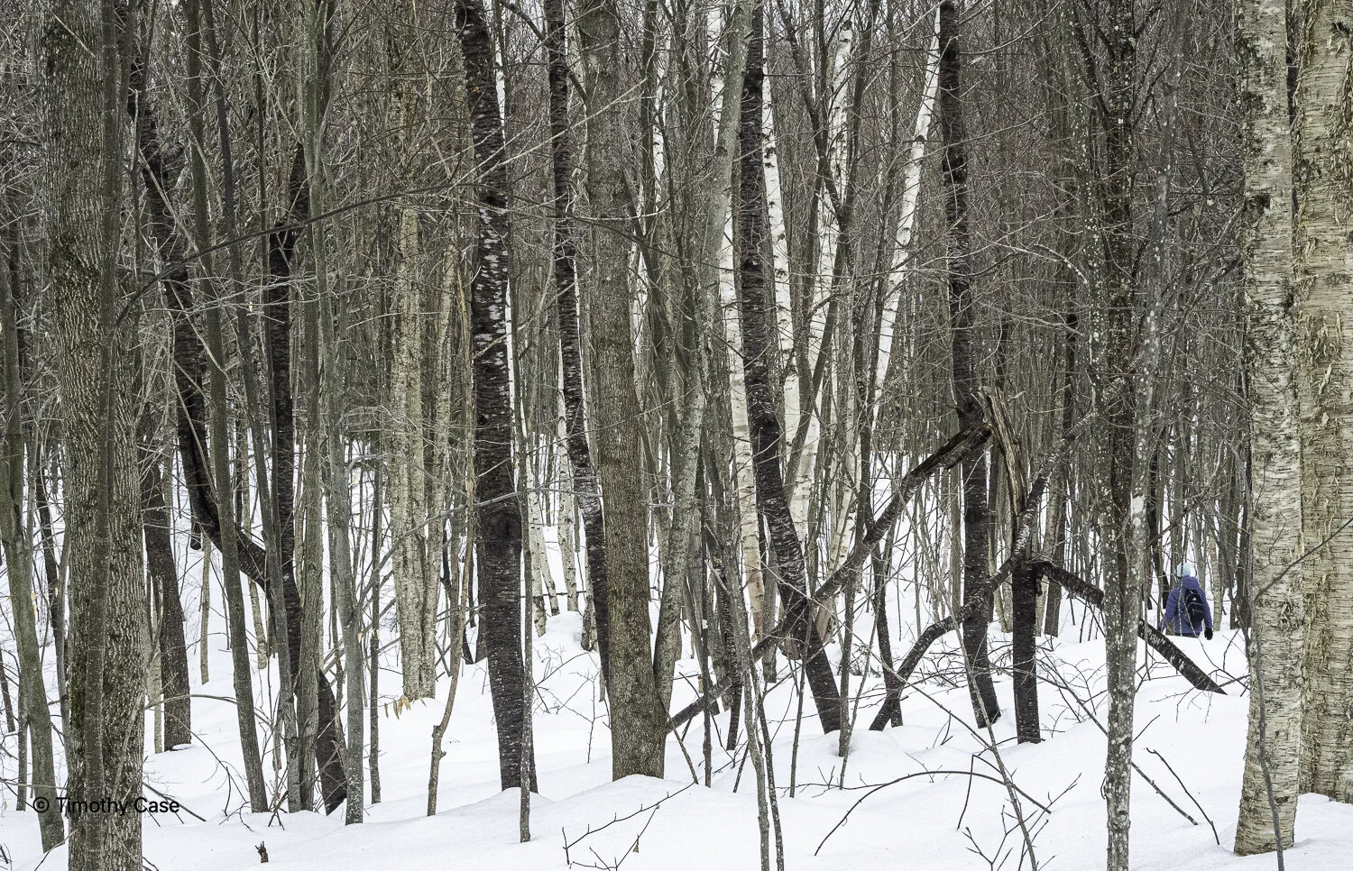
Williams Woods is a mature valley clayplain forest in the Champlain Valley and it’s a Nature Conservancy property. I’ve ridden by this forest on my bike several times, aware from seeing it in passing that it’s a mature forest, but this is the first time I’ve been in it. The forest is a very diverse ecosystem and home to a lot of very old and large trees, including white oak, red oak, red maple, white pine, shagbark hickory and white ash. Associated species include hemlock, sugar maple, beech and bur oak. There are many snags and nurse logs and while I’m not sure this is technically old growth, it has the appearance of it. While this forest type once covered thousands of acres in the Champlain Valley, woodlands like these are now rare. The flat trail through the forest is about a mile, although it took us about 2 hours to walk it as we inspected many of the trees and I took a lot of photos. I’m very curious to see what wild flowers emerge later this spring.
Williams Woods, March 21, 2021
Sony A7RIV and Sony 12-24 f/4
Eastern White Pine Snag
Williams Woods, March 21, 2021
Sony A7RIV and Sony 12-24 f/4
Northern Red Oak
Williams Woods, March 21, 2021
Sony A7RIV and Sony 12-24 f/4
Williams Woods, March 21, 2021
Sony A7RIV and Sony 12-24 f/4
Williams Woods, March 21, 2021
Sony A7RIV and Sony 12-24 f/4
Williams Woods, March 21, 2021
Sony A7RIV and Sony 12-24 f/4
Williams Woods, March 21, 2021
Sony A7RIV and Sony 12-24 f/4
Williams Woods, March 21, 2021
Sony A7RIV and Sony 12-24 f/4
Williams Woods, March 21, 2021
Sony A7RIV and Sony 12-24 f/4
Williams Woods, March 21, 2021
Sony A7RIV and Sony 12-24 f/4
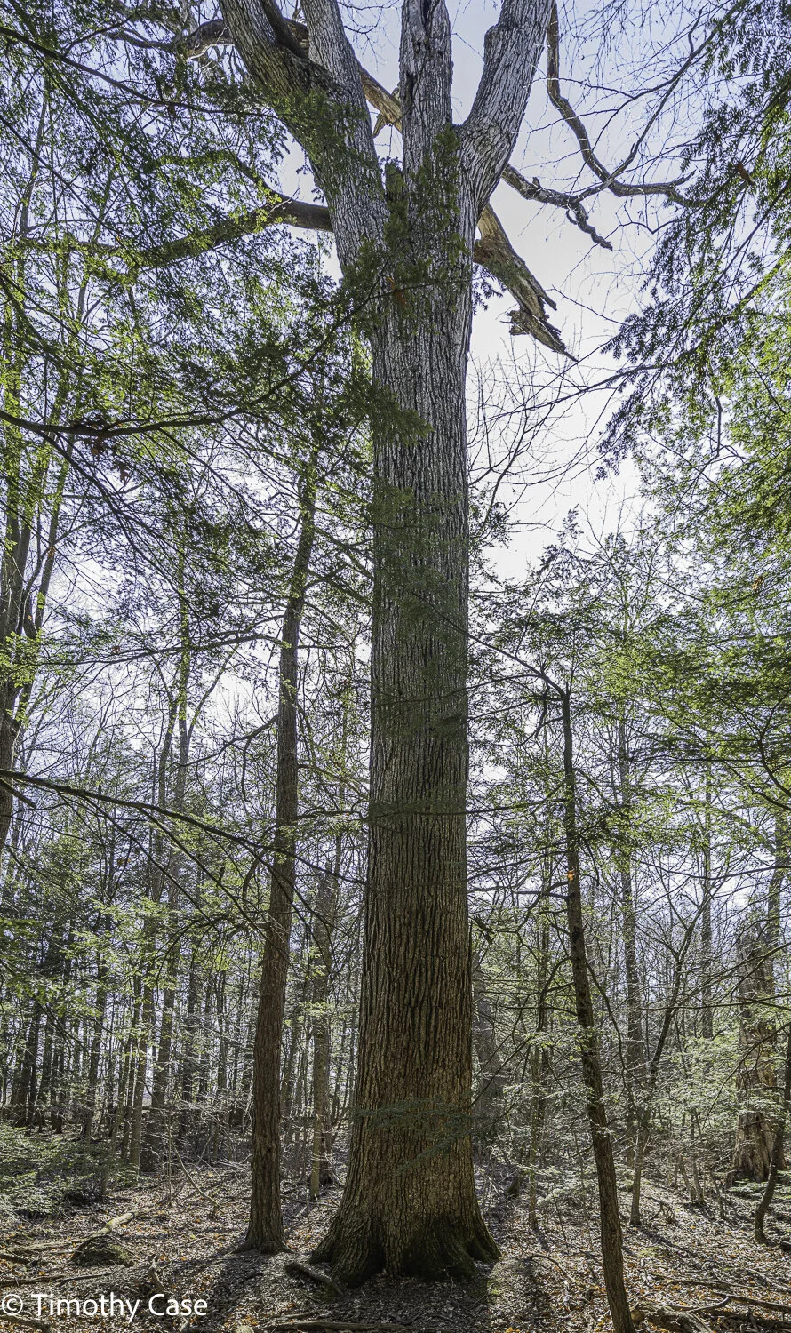
This is a very old specimen of an eastern white ash, the tallest and with the deepest bark I’ve seen.
Williams Woods, March 21, 2021
Sony A7RIV and Sony 12-24 f/4
Williams Woods, March 21, 2021
Sony A7RIV and Sony 12-24 f/4
Eastern White Pine
Williams Woods, March 21, 2021
Sony A7RIV and Sony 12-24 f/4
Williams Woods, March 21, 2021
Sony A7RIV and Sony 12-24 f/4
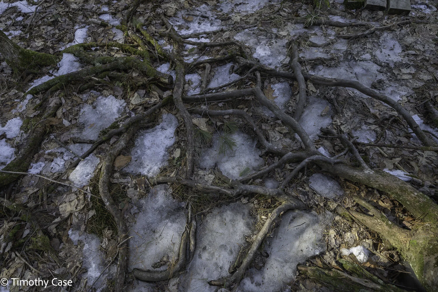
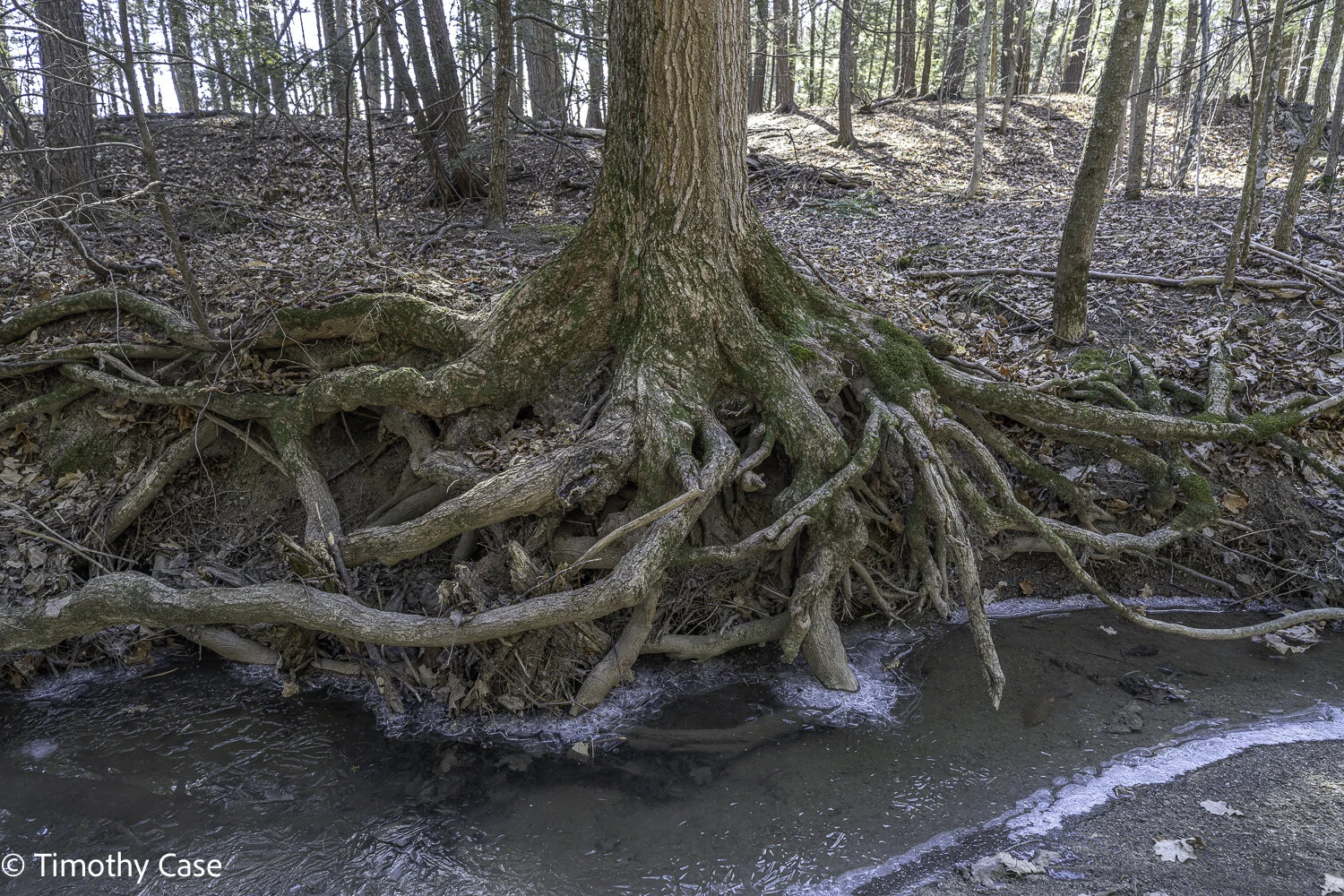
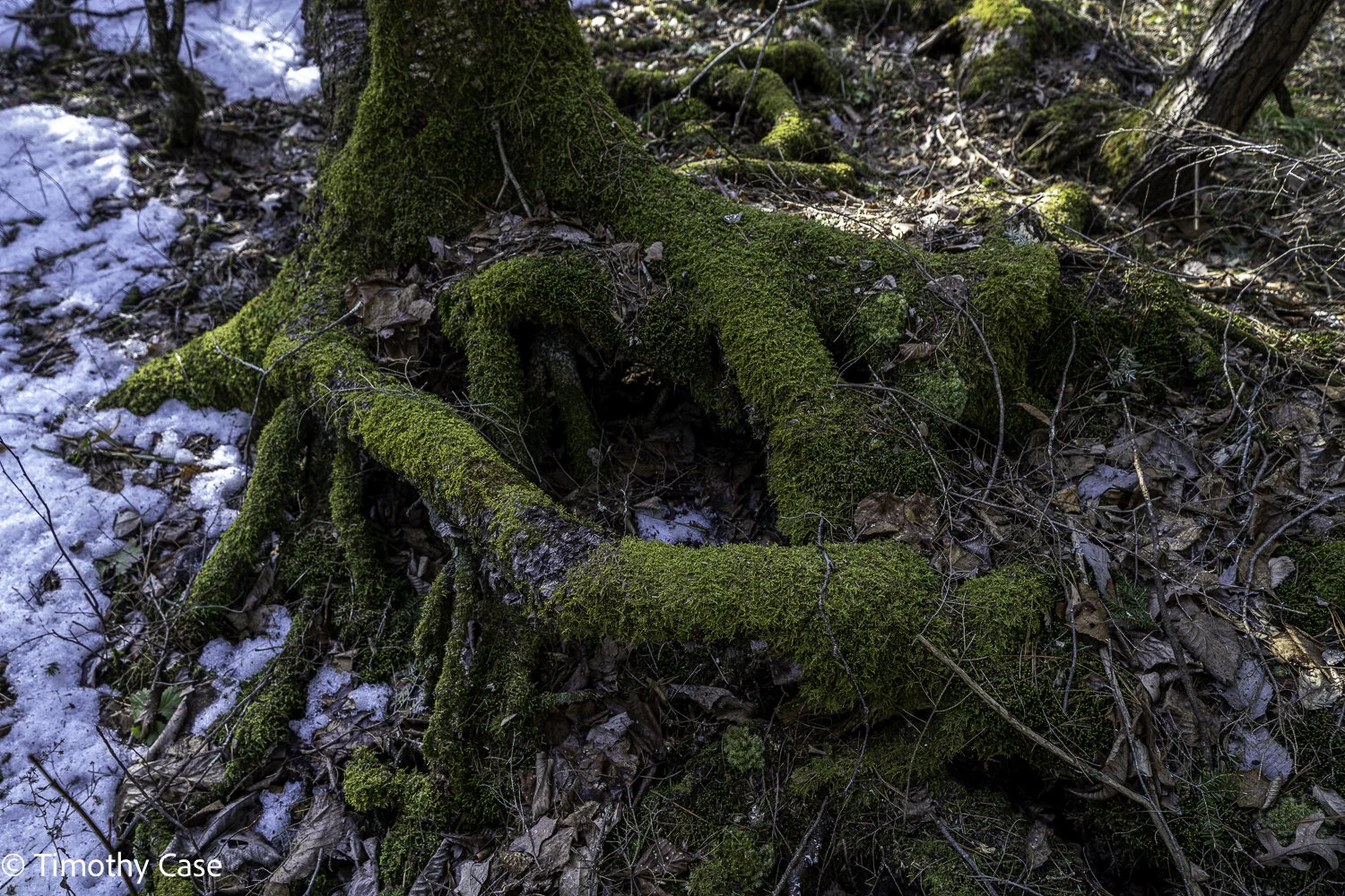
Root Mass
Williams Woods, March 21, 2021
Sony A7RIV and Sony 12-24 f/4
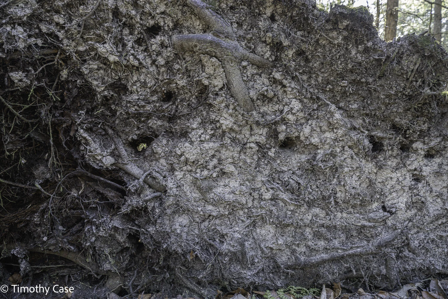
Tip-Over
Williams Woods, March 21, 2021
Sony A7RIV and Sony 12-24 f/4
Eastern Hemlock
Williams Woods, March 21, 2021
Sony A7RIV and Sony 12-24 f/4
Barbara alongside a white ash
Williams Woods, March 21, 2021
Sony A7RIV and Sony 12-24 f/4
Water Tower Trails
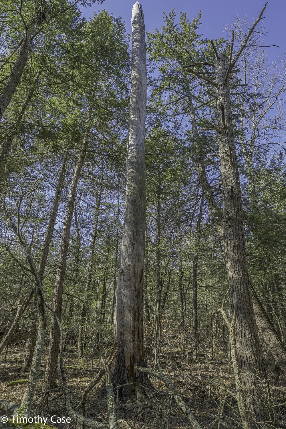
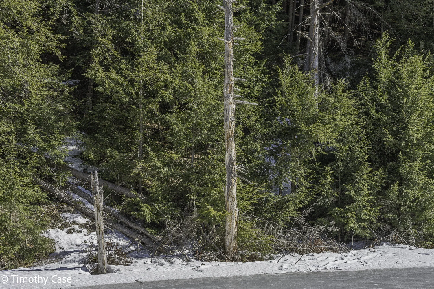
Behind the Robert Frost Interpretive Trail is access to the 70 miles of trails of the Moosaslamoo National Recreation Area. While the forest here is not old growth, the areas within continually transition interestingly from one type of natural area to another and contain large and old tree specimens, including a nearby stand of old eastern hemlocks. The main reason I returned today was to revisit a wonderful, very large hemlock specimen in the hemlock forest that I’d measured earlier, although it’s particular placement in the forest and the undergrowth make photographing it challenging and I haven’t tried to photograph it yet.
Moosalamoo NRA, 3.17.2021
Sony A7RIV and Voitlander 50mm f2
Base of a snag
Moosalamoo NRA, 3.17.2021
Sony A7RIV and Voitlander 50mm f2
Black Cherry Bark
Moosalamoo NRA, 3.17.2021
Sony A7RIV and Voitlander 50mm f2
Yellow Birch
Moosalamoo NRA, 3.17.2021
Sony A7RIV and Voitlander 50mm f2
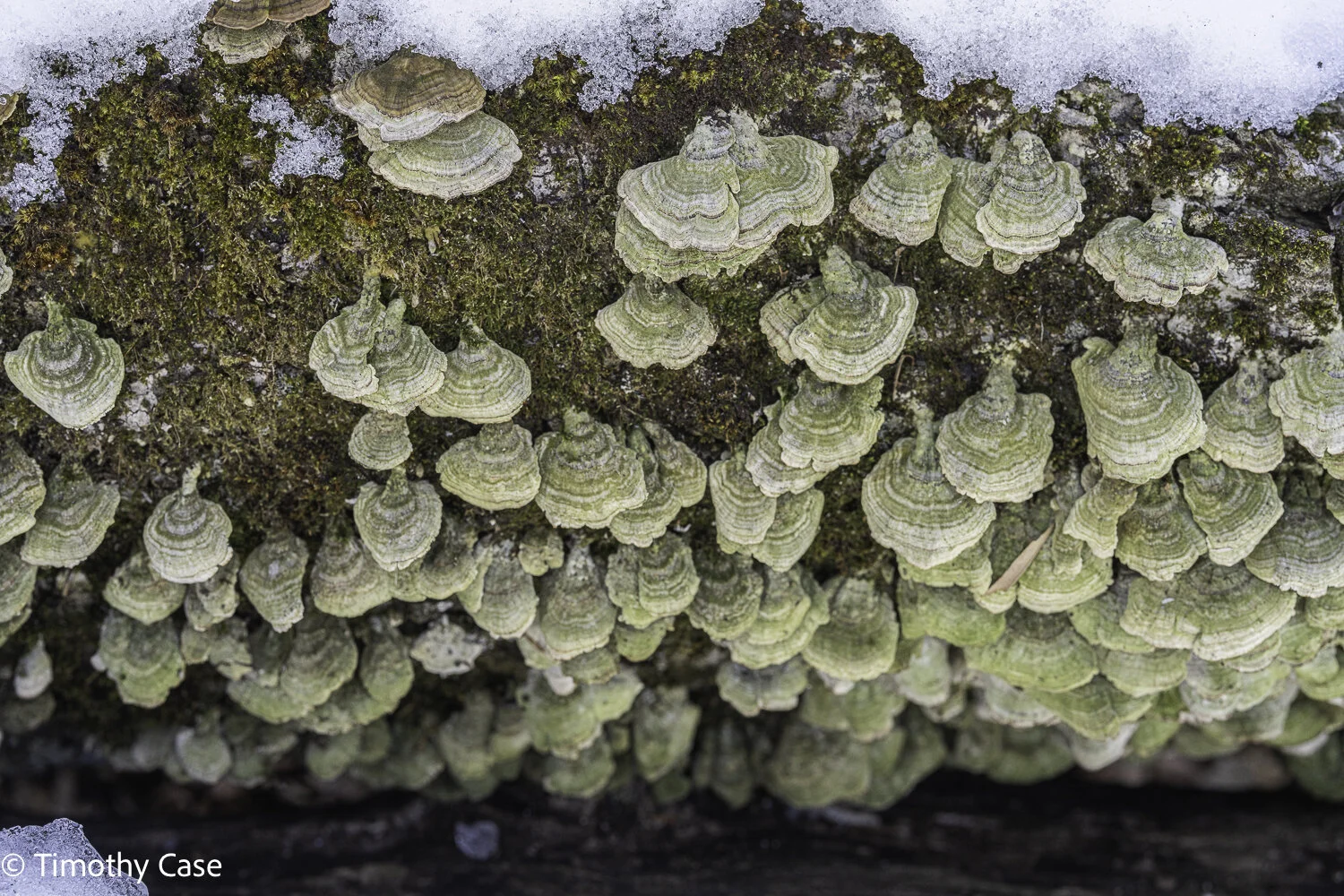
Fungus on a log
Moosalamoo NRA, 3.17.2021
Sony A7RIV and Voitlander 50mm f2
Moosalamoo NRA, 3.17.2021
Sony A7RIV and Voitlander 50mm f2
Robert Frost Interpretative Trail, 3.17.2021
Sony A7RIV and Voitlander 50mm f2
Robert Frost Interpretative Trail, 3.17.2021
Sony A7RIV and Voitlander 50mm f2
High Pond Trail at Half-Moon Pond State Park
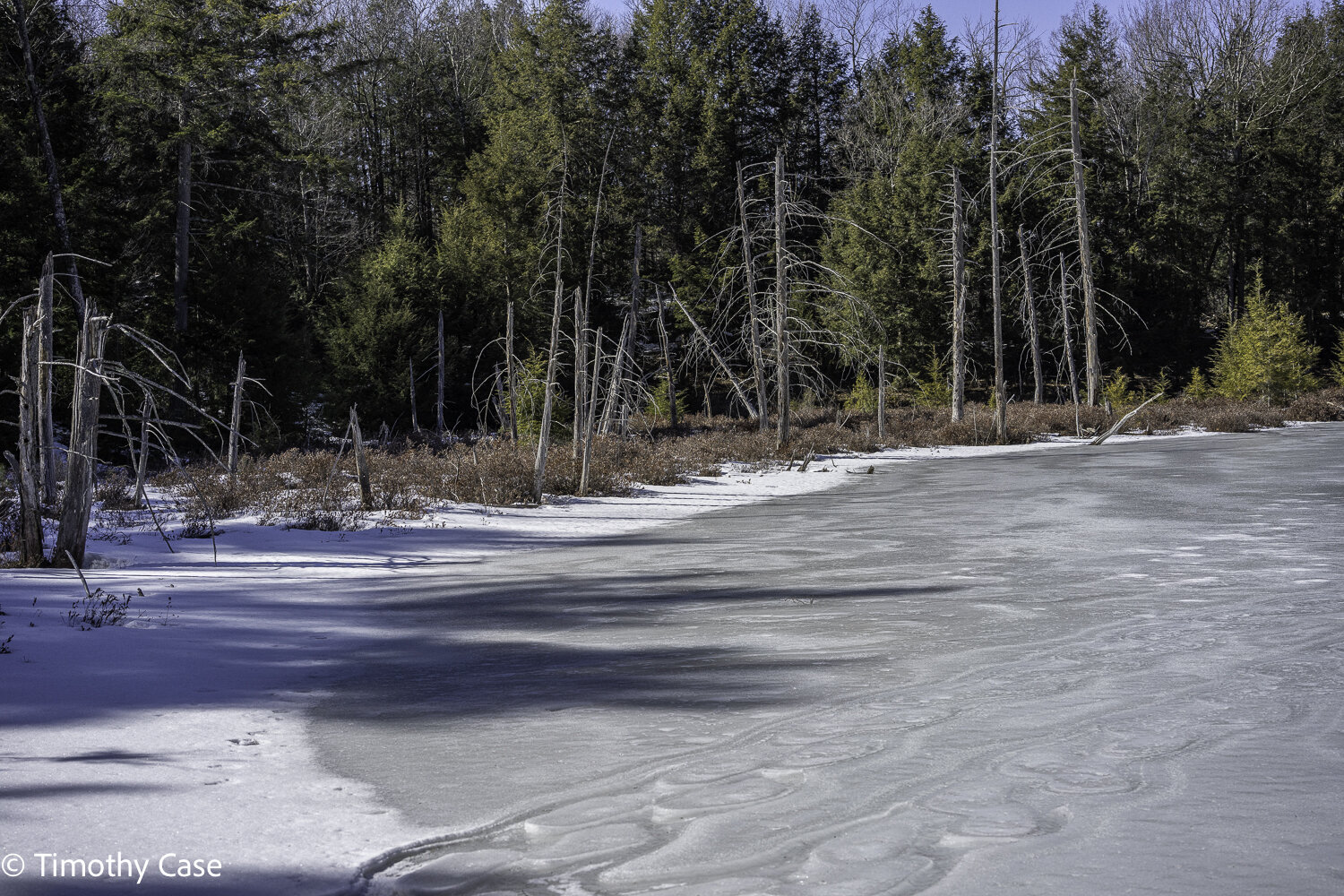
I wanted to return in winter in order to walk on the frozen pond at the top of the trail and to see if there were any visible changes in the beaver pond since we were here in December (there weren’t). This is a beautiful forest and as the trail is short and only moderately hilly in places, it’s perfect for a quick and easy hike.
The new beaver pond has created wetlands, the benefits of which include flood control, reduced soil erosion and greater biodiversity. Almost half of endangered and threatened species in North America rely upon wetlands.
The terrain is variable and interesting along the trail.
High Pond At Half Moon Lake, 3.15.2021
Sony A7RIV and Voitlander 50mm f/2
Tree snag along the edge of High Pond
High Pond At Half Moon Lake, 3.15.2021
Sony A7RIV and Voitlander 50mm f/2
Today, the pond was frozen solid and was safe to walk on. What this image shows, however, is evidence of recent runoff when the temperatures were warmer. I’d always assumed a the surface of a pond was flat, even when frozen, but apparently not.
High Pond At Half Moon Lake, 3.15.2021
Sony A7RIV and Voitlander 50mm f/2
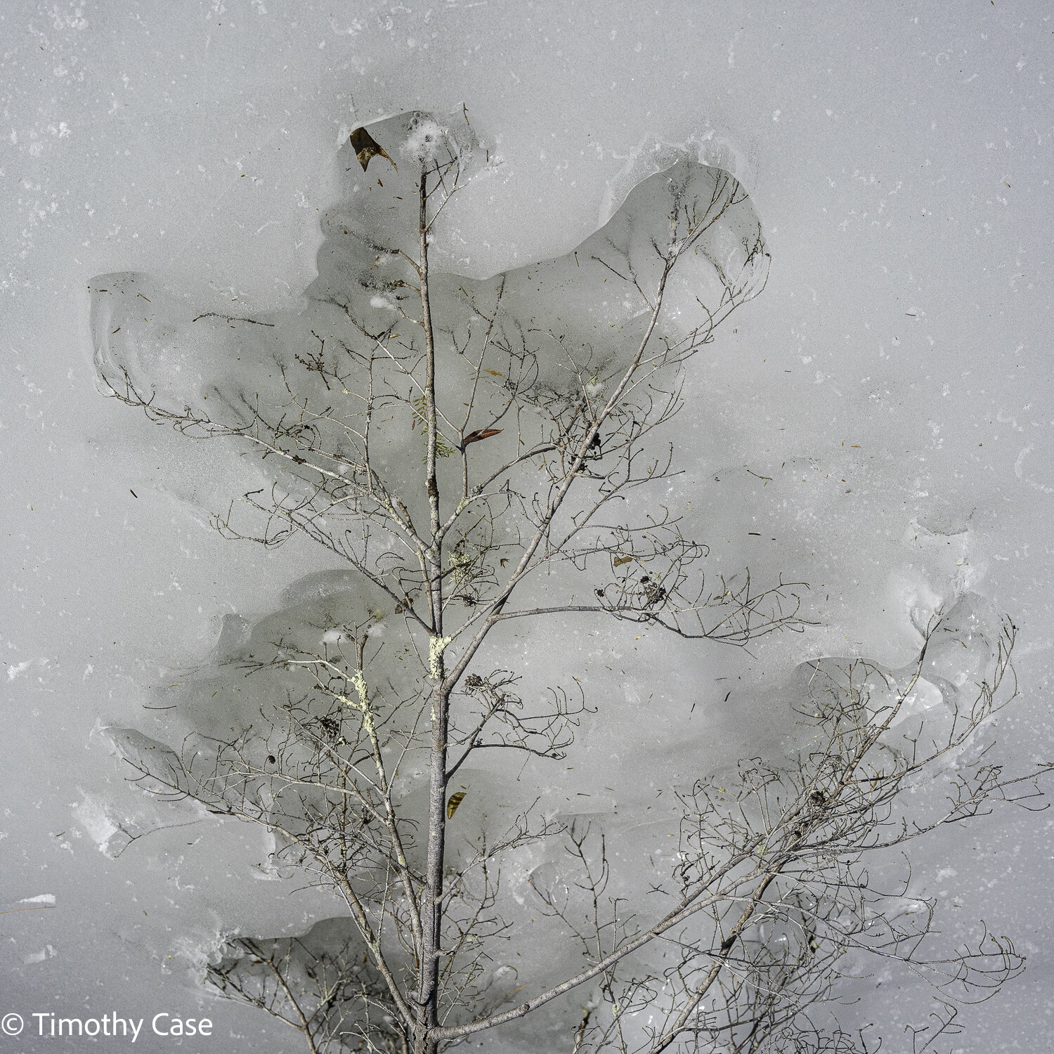
The the darker surface of the twig absorbs heat from the sun and melts the lighter colored and cooler surface of the ice.
High Pond At Half Moon Lake, 3.15.2021
Sony A7RIV and Voitlander 50mm f/2
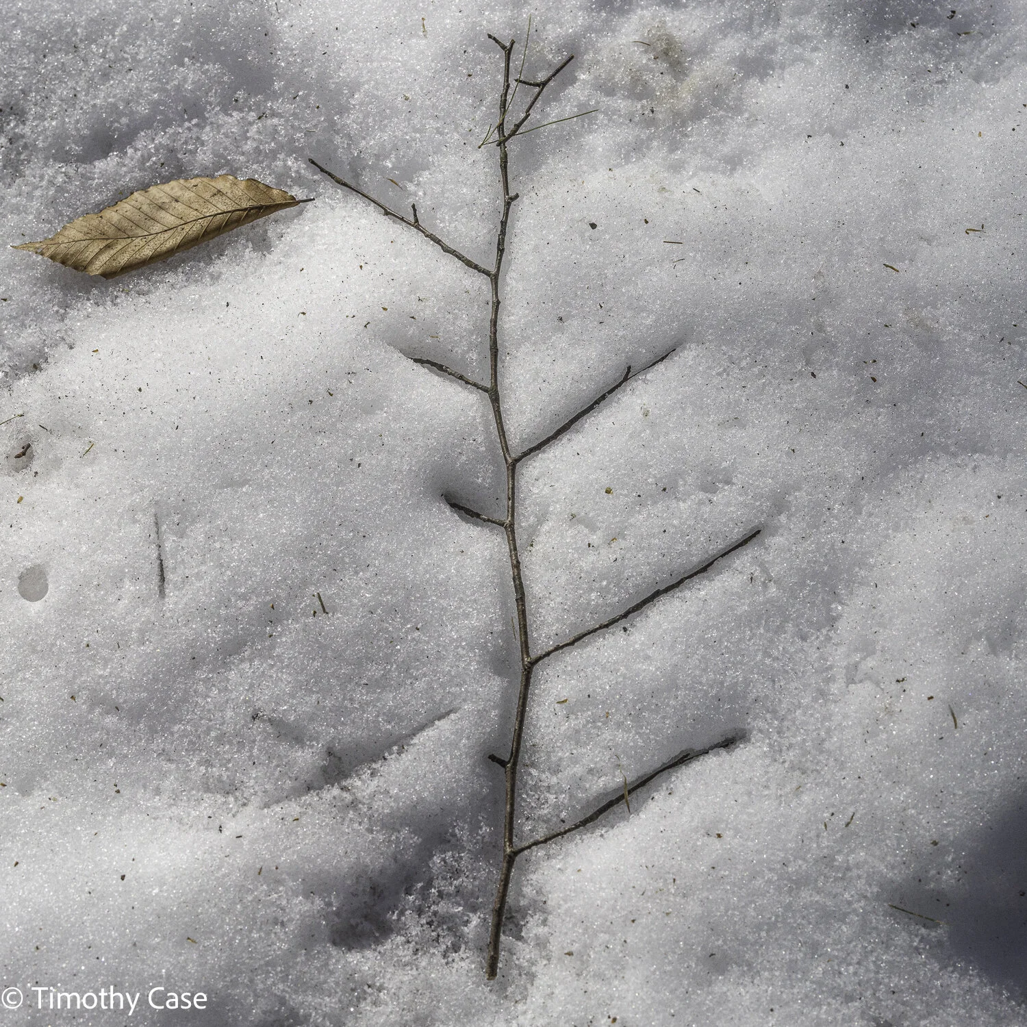
Another example of a darker, warmer surface melting the lighter, cooler surface of the ice.
High Pond At Half Moon Lake, 3.15.2021
Sony A7RIV and Voitlander 50mm f/2
Snake Mountain
Snake Mountain is probably the most popular local hike. It passes through Willmarth Woods Natural Area, a Nature Conservancy property with large maples, ash and white pine trees. The trail is moderate and provides a spectacular view of Champlain Valley, Lake Champlain, and the Adirondacks. The temperatures were in the 30s today and packed snow covered the ground, which made navigating the trail easy.
Willmarth Woods Natural Area, adjacent to the trail to Snake Mountain. 3-08-2021
Olympus M5II, Olympus 12-45 f/4
Willmarth Woods Natural Area, 03-08-2021
Olympus M5II, Olympus 12-45 f/4
Snake Mountain, 03-08-2021
Olympus M5II, Olympus 12-45 f/4
Willmarth Woods Natural Area, Snake Mountain, 03-08-2021
Olympus M5II, Olympus 12-45 f/4
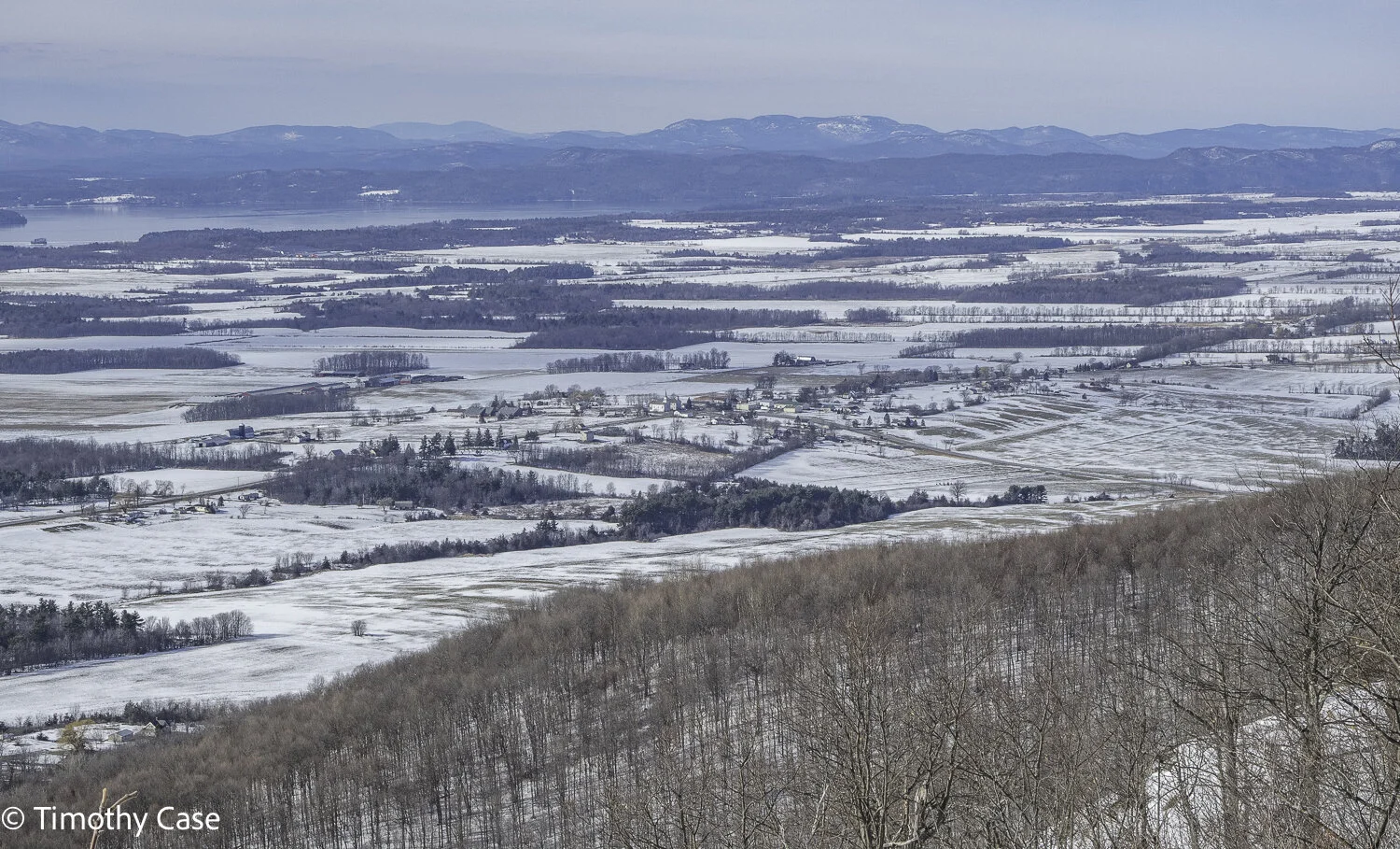
Snake Mountain Overlook
Addison 4-Corners, Champlain Valley, Lake Champlain, & the Adirondack Mountains
Olympus M5II, Olympus 12-45 f/4
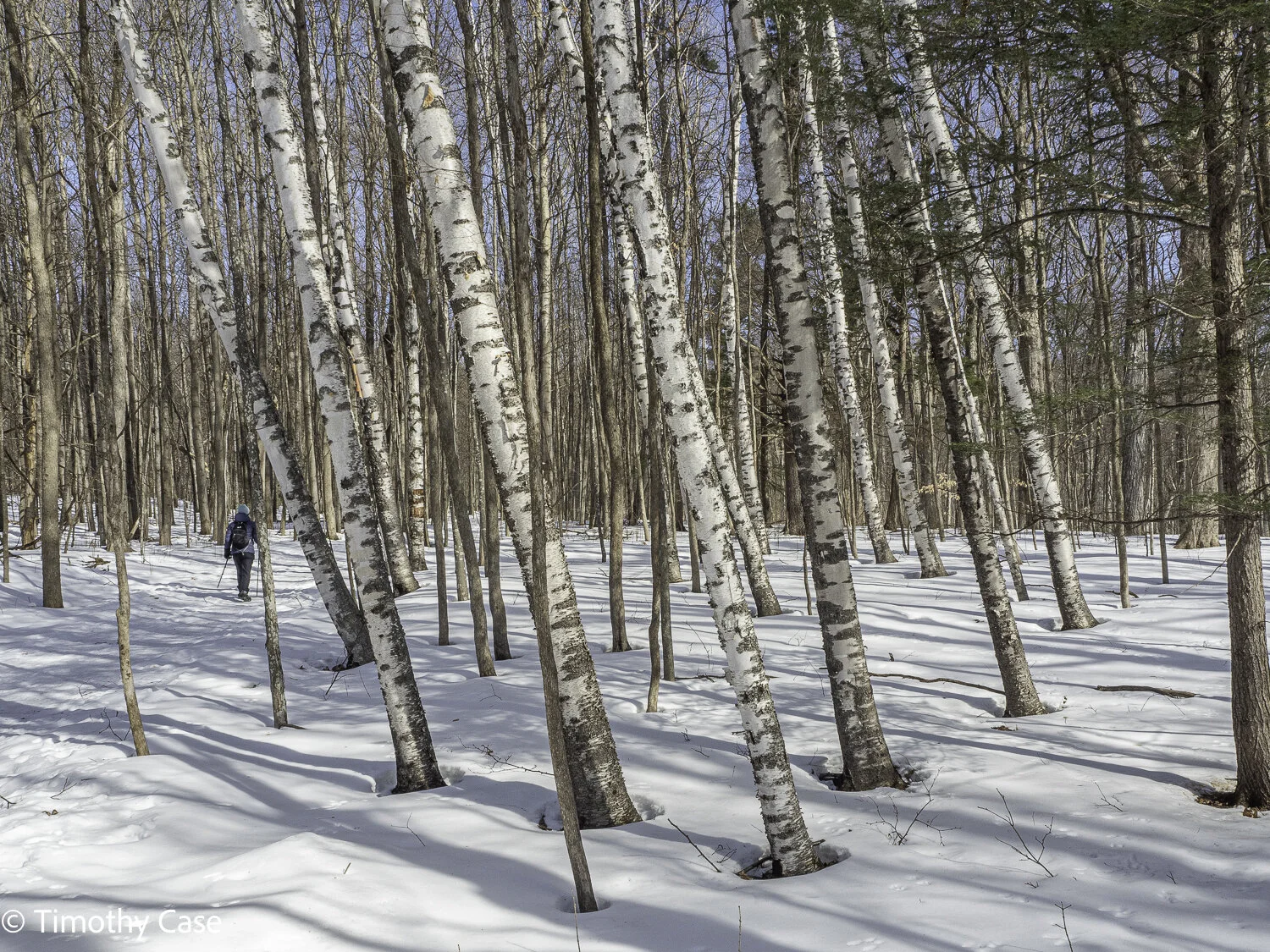
Barbara and a Copse of Grey Birch
Wiillmarth Woods Natiral Area, Snake Mountain, Addison County,
Olympus M5II, Olympus 12-45 f/4
Willmarth Woods Natural Area
While modest in size at 81 acres, Willmarth Woods Preserve, a Nature Conservancy property, is one of the largest low-elevation, mature forests in the Champlain Valley. The trees species in the forest include northern red oak, eastern beech, white ash and eastern white pine, The Woods flanks the 1,215-acre Snake Mountain Wildlife Management Area where a moderately difficult trail leads to the 1,215 foot summit and a spectacular view of the Champlain Valley and the Adirondacks.
Willmarth Woods Natural Area, March 3, 2021
Sony A7RIV & Voitlander 21mm f/3.5
Willmarth Woods Natural Area, March 3, 2021
Sony A7RIV & Voitlander 21mm f/3.5
Willmarth Woods Natural Area, March 3, 2021
Sony A7RIV & Voitlander 21mm f/3.5
Willmarth Woods Natural Area, March 3, 2021
Sony A7RIV & Voitlander 21mm f/3.5
Widow's Crossing Trail
March 1 arrived and the temperature in the mountains was in the low 40s. Until I gained more experience with the arrival of March in Vermont, I considered this month as early spring. In spite of warmer, shorter winters here due to climate change, March is still definitely winter in Vermont. While 40°F today up the mountain, tonight the valley forecast is 5°F.
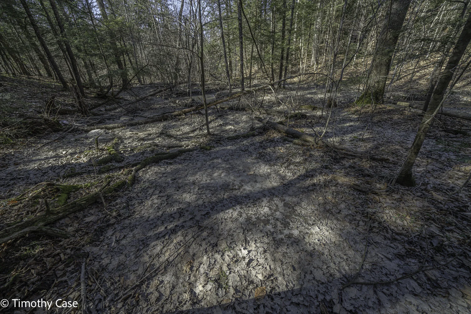
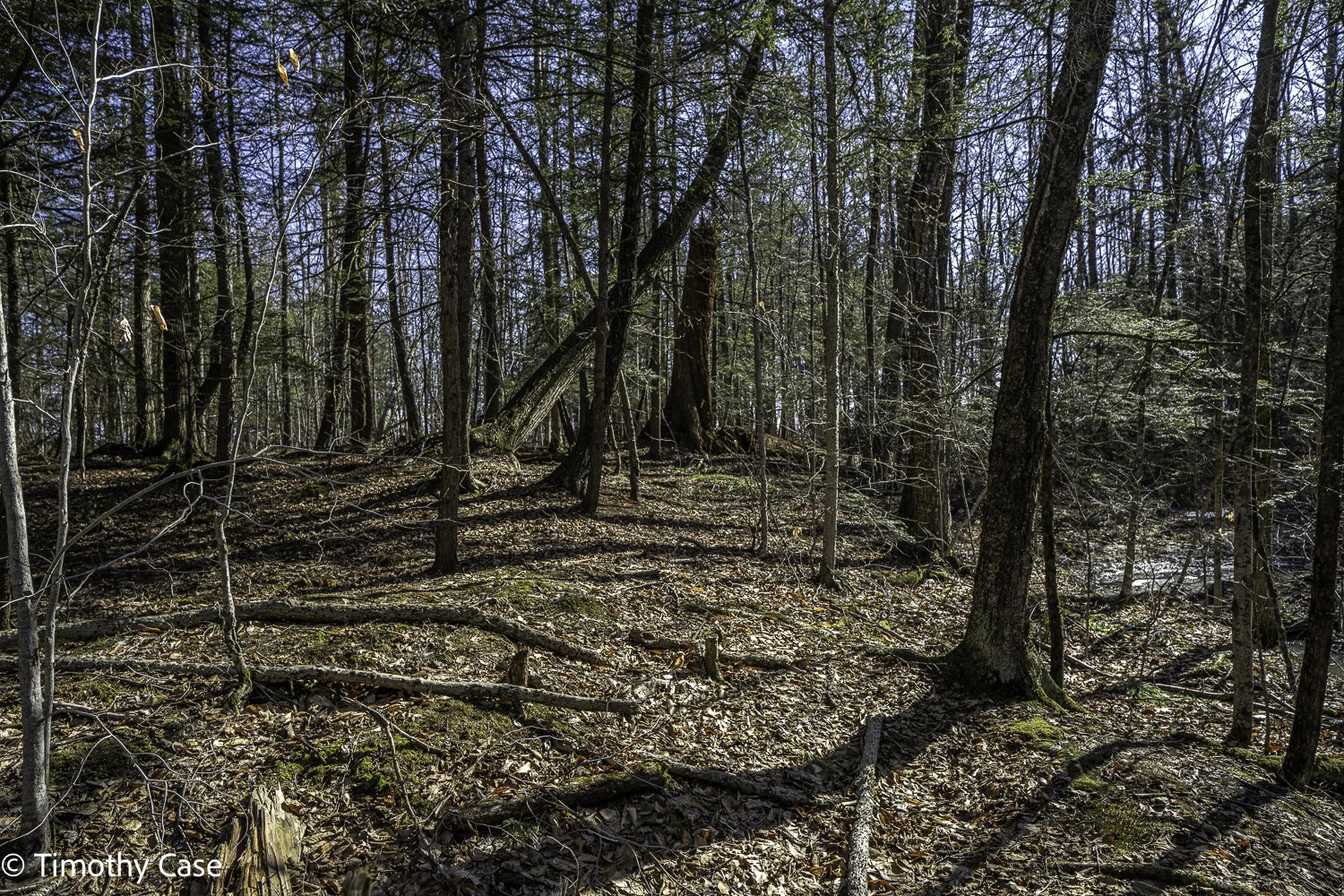
The hike on the Widows Clearing Trail in the Moosalamoo National Recreation Area begins to ascend right from the trailhead, While the snow off trail is around 18-24” on the trail was packed down and we didn’t need showshoes. While there is no old growth in this area, the forest progression remains interesting and engaging. We began in a Hemlock forest that transitioned to one dominated by birches. The remainder was the more typical mix of deciduous and coniferous. If you pay attention, you’ll see that the forest isn’t nearly as uniform as it appears from a distance and you’ll see that the 100-150 year old forests around are differentiated and are comprised of smaller individual natural areas with slightly different physical environments and mixes of trees. Proximity to water, availability of light and the soil and subsoil composition influence what trees thrive where within even the managed Green Mountain National Forest.

This is Widow’s Clearing and I noticed that the Eastern Hemlocks along the front of the forest are dead and dying. I will return later to see if the trees are showing any evidence of Hemlock woolly adelgid.
Widow’s Clearing Trail, Moosalamoo National Recreation Area, 03-01-2021
Olympus M5II, Olympus 12-45 f/4
The black trunks are Black Birch. There are also Paper Birch, Yellow Birch, maybe one Grey Birch, and a few American Beech.
Widow’s Clearing Trail, Moosalamoo National Recreation Area, 03-01-2021
Olympus M5II, Olympus 12-45 f/4
As near as I can make out from the photo, the trees in front with dark bark are Eastern Hemlock, while the 3 trees with light bark are, from the left, Yellow Birch, Paper Birch and Grey Birch. There are also a lot of Sugar Maple, the most common tree in Vermont, American Beech, White Pine, and White Ash in these forests, as well trees from the oak, pine, spruce families.
Widow’s Clearing Trail, Moosalamoo National Recreation Area, 03-01-2021
Olympus M5II, Olympus 12-45 f/4
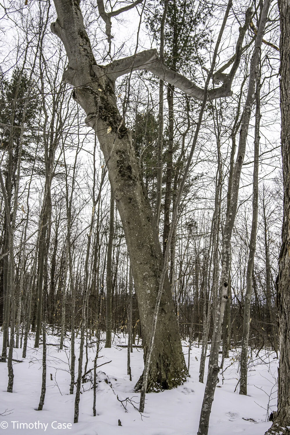
Probably a Sugar Maple,
Widow’s Clearing Trail, Moosalamoo National Recreation Area, 03-01-2021
Olympus M5II, Olympus 12-45 f/4
American Beech with beech bark disease caused by the beech scale insect, Cryptococcus fagisuga. A disconcertingly high number of the trees around here have the disease. The tree provides a lot of nutritious mast for wildlife and will impact the ecosystem as the beech die off.
Widow’s Clearing Trail, Moosalamoo National Recreation Area, 03-01-2021
Olympus M5II, Olympus 12-45 f/4
American Beech, but the specimen presents differently from those I usually see.
Widow’s Clearing Trail, Moosalamoo National Recreation Area, 03-01-2021
Olympus M5II, Olympus 12-45 f/4
Widow’s Clearing Trail, Moosalamoo National Recreation Area, 03-01-2021
Olympus M5II, Olympus 12-45 f/4
Another area of the forest with a variety of birches and American Beech.
Widow’s Clearing Trail, Moosalamoo National Recreation Area, 03-01-2021
Olympus M5II, Olympus 12-45 f/4
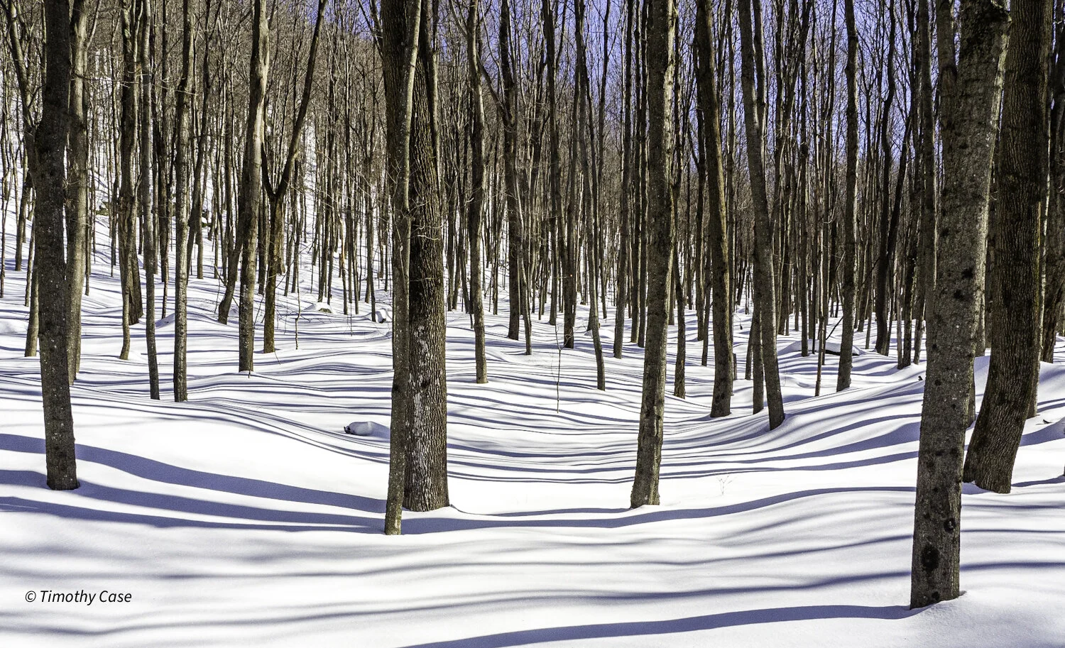
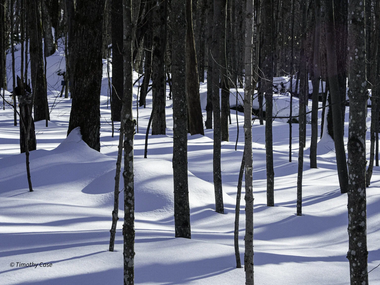
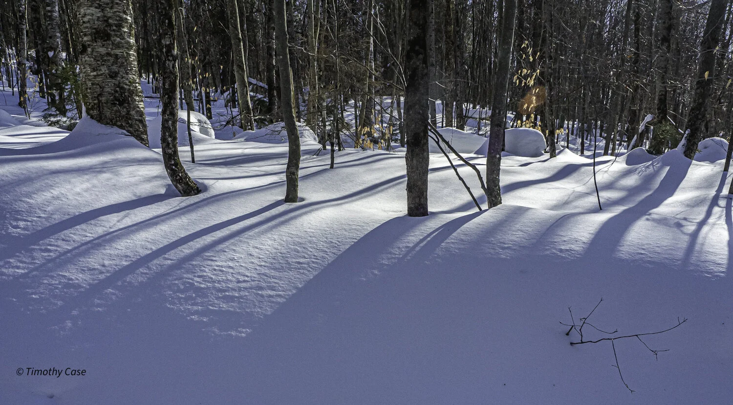
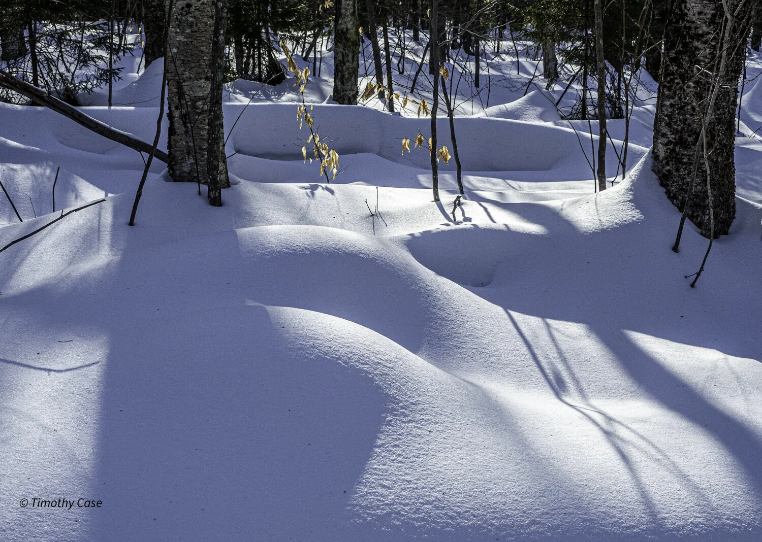
Hogback Mountain Loop
Hogback Mountain Loop, Addison County, Vermont 02-26-2021
Olympus M5II and Olympus 12-45 f/4.
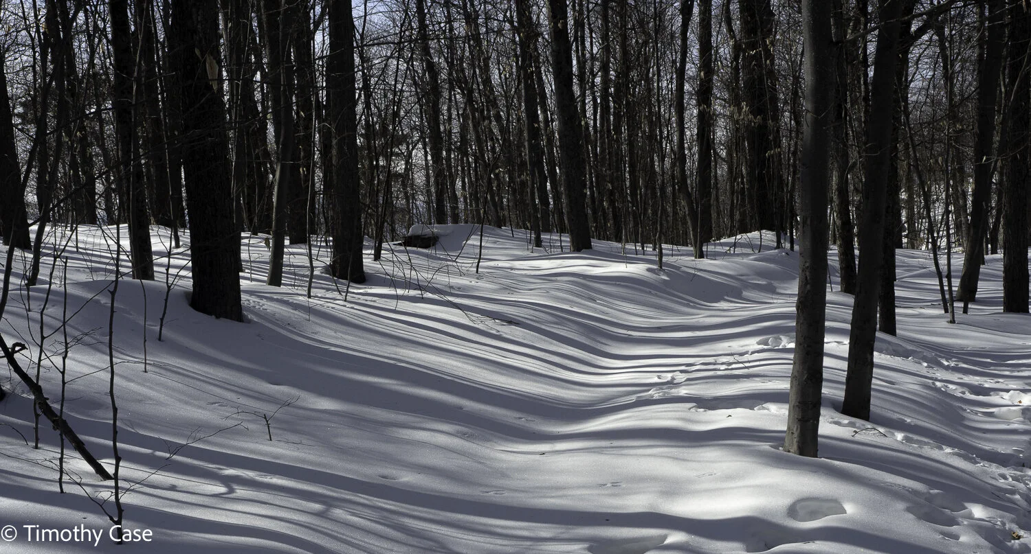
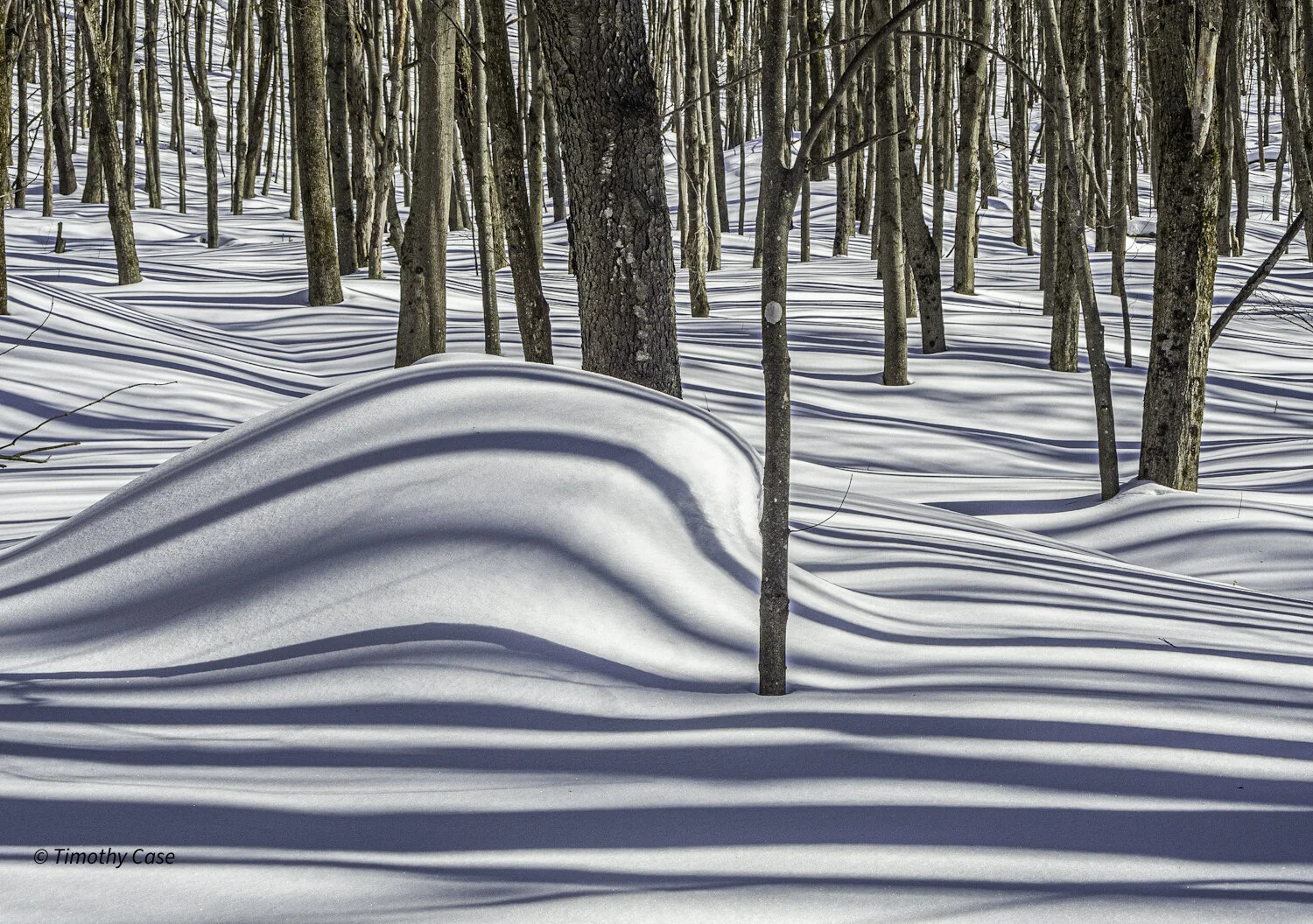
We snowshoed the 3-mile Hogback Mountain Loop behind Blueberry Hill Inn and Outdoor Center in the Green Mountains about 15 miles from Middlebury. The trail is not very steep, the snow was well tamped down from use, and the temperatures were in the upper 20’s—perfect for snowshoeing. It took us 2 hours to complete the loop because I stopped so many times to take photos and walked slowly in order to take in the day’s beauty. The sun is still low in the sky this time of year, and the midday light shining through the trees projected aesthetically arresting shadows throughout the forest. There is an actual hill of blueberries with about 35 acres of blueberry bushes that can be picked when ripe in late July-early August. The area with the blueberries also provides a broad, open, and unusually close-up view of the ridgeline of the Green Mountains. As if all of this stunning beauty wasn’t enough, a ridgeline dense with the craggier peaks of the Adirondack Mountains is also visible from here. This is another place we will add to our list of gorgeous places to visit at least once a season.
Hogback Mountain Loop, Addison County, Vermont 02-26-2021
Olympus M5II and Olympus 12-45 f/4.
Hogback Mountain Loop, Addison County, Vermont 02-26-2021
Olympus M5II and Olympus 12-45 f/4.

Deer Tracks Through the Forest
Hogback Mountain Loop, Addison County, Vermont 02-26-2021
Olympus M5II and Olympus 12-45 f/4.
Hogback Mountain Loop, Addison County, Vermont 02-26-2021
Olympus M5II and Olympus 12-45 f/4.
Hogback Mountain Loop, Addison County, Vermont 02-26-2021
Olympus M5II and Olympus 12-45 f/4.

These Yellow Birch have a buttery tint.
Hogback Mountain Loop, Addison County, Vermont 02-26-2021
Olympus M5II and Olympus 12-45 f/4.
Route 67
Tones
Route 67, Addison County, Vermont 2021-02-20
Olympus M5II and Olympus 12-45 f/4
Route 67 is a two lane national forest dirt road that is closed to traffic in winter, at which time the road is available to hikers, snowshoers, cyclists, skiers, horses and snow machines (as they are called around here). This was our first visit here. The temperature was in the mid-20s and the skies were clear. Given the fabulous conditions, there were quite a few others enjoying the day, too, including some number of snowmobiles. I don’t mind them, but if you do, you’re better off coming on a workday.
We snowshoed 3 miles total, up and back, and the groomed road was perfect for snowshoeing. We did not, however, venture off the road and into the forest as the undisturbed snow was deep and fluffy and required too much effort to navigate. The groomed road is also perfect for cross country skiing and we’re going to return in a few days with our skis.
Dotted
Route 67, Addison County, Vermont 2021-02-20
Olympus M5II and Olympus 12-45 f/4
Bent Gray Birch
Route 67, Addison County, Vermont 2021-02-20
Olympus M5II and Olympus 12-45 f/4